What are Santa Ana winds, and why are they so dangerous?
This story deserves to be shared
Send it to someone who'd care, or post it on your networks.
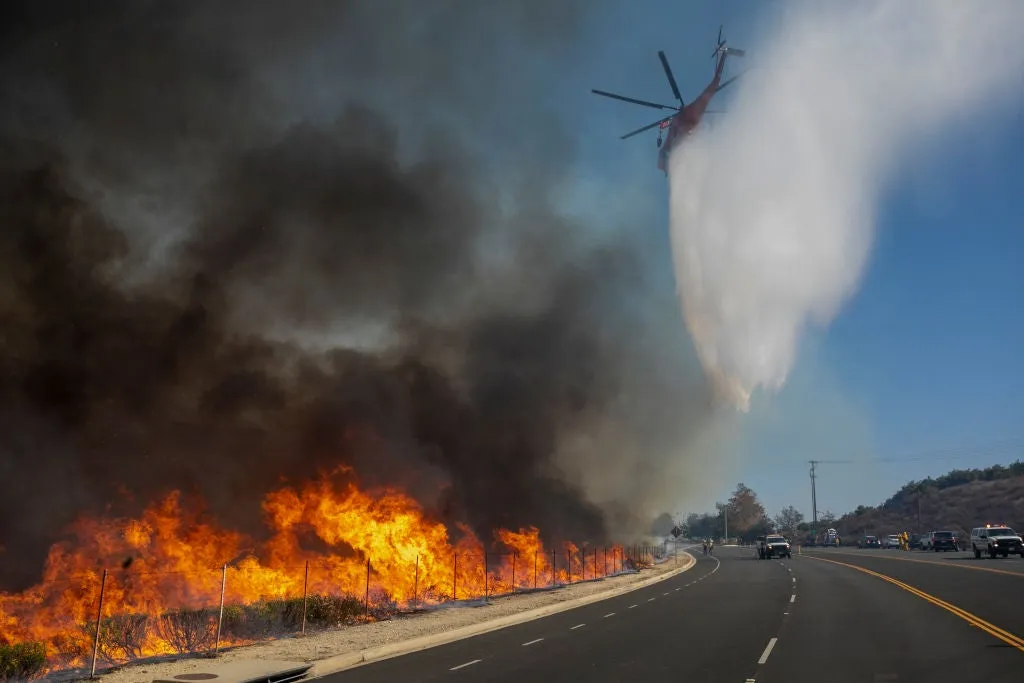
What are Santa Ana winds, and why do they fuel California wildfires? Santa Ana winds can down trees, trigger power outages and even damage buildings. They're also notorious for fanning some of the most destructive wildfires in Southern California history. What are Santa Ana winds? These winds form when an area of high pressure builds over the Great Basin, a region in the Intermountain West that includes Nevada and parts of other neighboring states. When this high forms, it creates a sharp pressure difference between the interior and the coast. Air then rushes downhill to the sea in an attempt to create balance. But there's an issue: California's mountain ranges get in the way.(MORE: The Pineapple Express is a firehose, and El Niño just turned it up)These hot, dry winds continue to speed up as they descend mountains. Any sparks can quickly become raging wildfires. This air is forced to squeeze through narrower mountain passes and canyons. One of these mountain ranges is the Santa Ana Mountains in Orange County, which is how these winds got their name in the first place.
This article is an excerpt. To read the full content, visit the original source. The Weather Channel
Related articles
Santa Ana winds boost danger as fires prompt evacuations
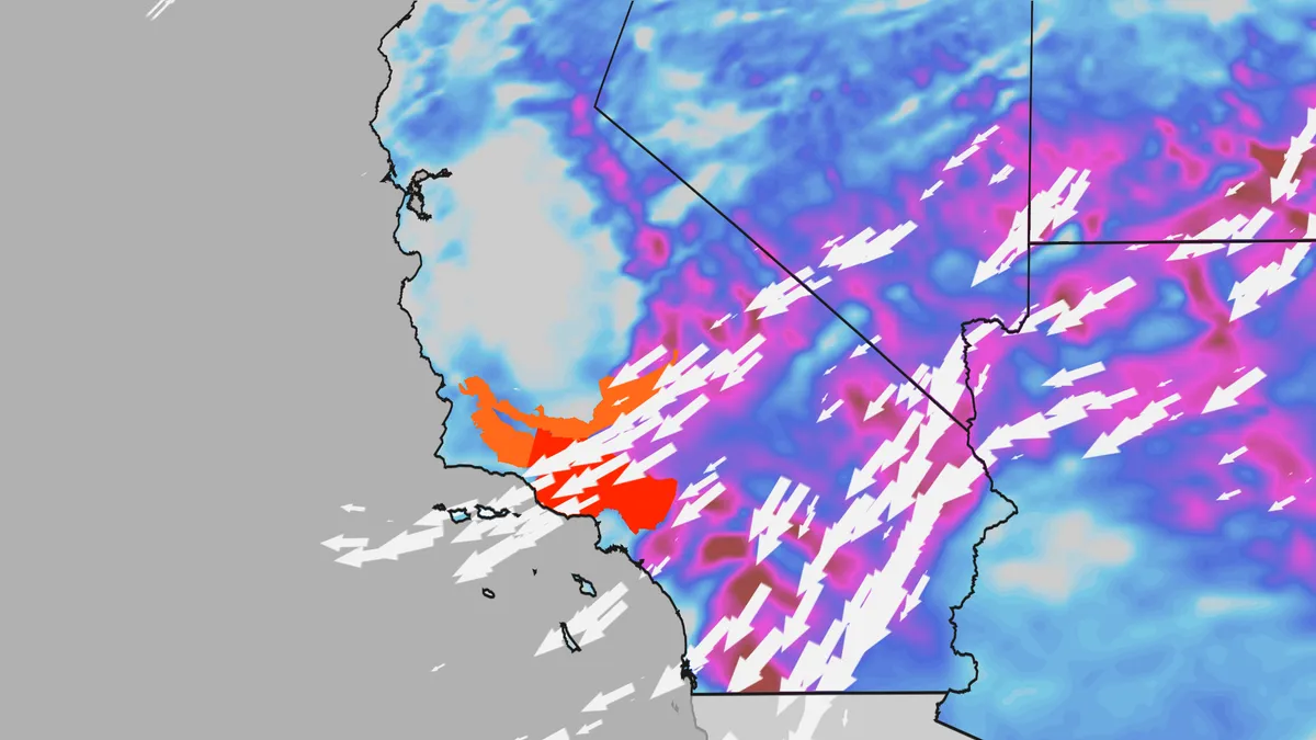
California's first Santa Ana wind event of the fall will wrap up this weekend. Gusty winds blasting the Los Angeles Basin increase the threat for rapidly spreading wildfires. Parts of Southern California and the Sierra Nevada could still see pockets of gusty winds, hot temperatures and dry air Sunday. (MORE: What are Santa Ana winds, and why are they so dangerous?)Here's the latestSeveral brush fires burn in Southern California Saturday, including the Bryson Fire, which has burned nearly 150 acres as of Saturday afternoon. The Norte Fire in Orange County, California, which has already impacted several homes, has burned over 500 acres. The Henderson Fire in San Diego County has burned over 3,000 acres and is 20% contained, also as of Saturday afternoon. Firefighters worked to contain two other fires that had sparked Thursday afternoon and triggered evacuation orders in the city of Azusa, north of L. A., and Camp Pendleton near San Diego, The Associated Press reported. Preparation for impacts — including damage to trees and power lines, blown away lawn furniture and holiday decorations and potential fire growth — should be rushed to completion.
Rare and destructive tornado strikes Italian towns in Sicily
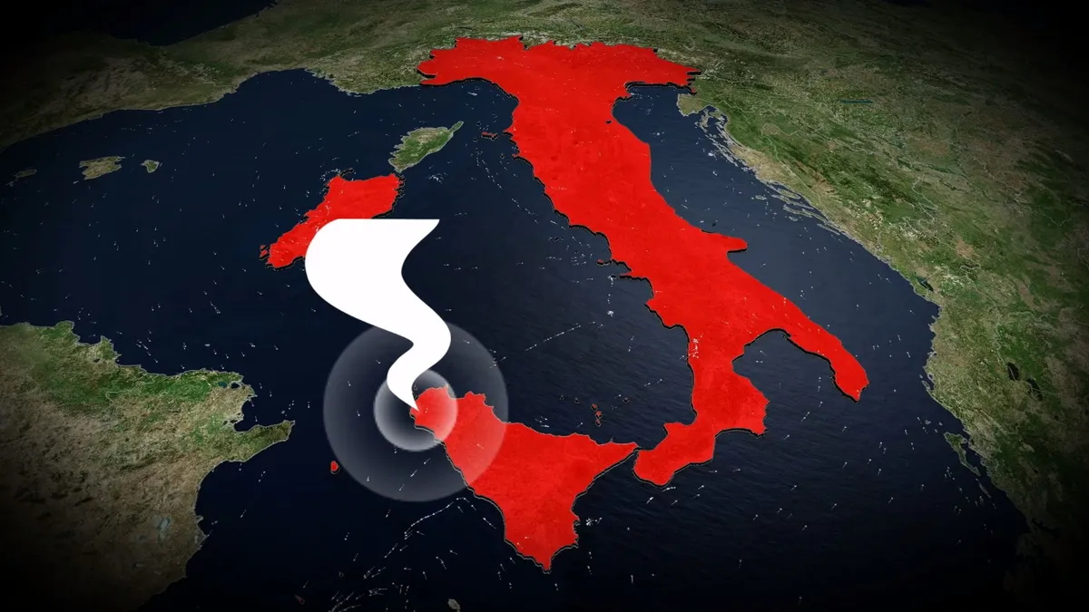
A rare tornado struck western Sicily on Friday, damaging homes and sending several people to the hospital. The storm reportedly began as a waterspout before coming ashore and tracking several kilometres inland, hitting the towns of Petrosino and Marsala, southwest of Palermo. DON’T MISS: Tornado, funnel cloud, waterspout, landspout, gustnado: what’s the difference? A video posted to Facebook appeared to show numerous vehicles overturned. Reuters reported on Friday that several people sustained injuries in the storm. Friday’s incident was an example of a tornadic waterspout, which is a full-fledged tornado that forms over water. These dangerous storms can track inland, as was the case in Sicily on Friday. Most of Italy’s organized tornado activity is centred within the Po Valley in the northern part of the country. Powerful supercell thunderstorms are known to hit cities between Milan and Venice with very large hail, destructive winds, and occasional tornadoes. Historical records hold several dozen reports of tornadoes in Sicily since the 19th century. A particularly damaging and deadly tornado struck the city of Catania on Oct. 7, 1884. WATCH: In a tornado warning?
Beware the 'I' hurricanes, even during a super El Niño
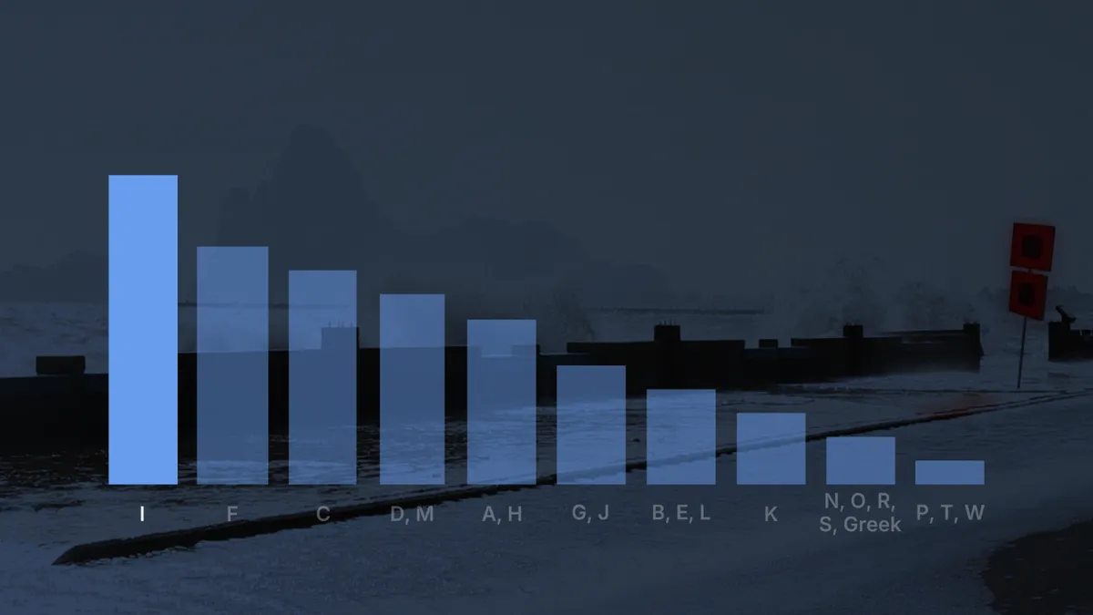
Hurricane Isaias appears to be the most impactful storm of the 2026 Atlantic hurricane season dominated by a super El Niño. So far this century, storms beginning with "I" have often been the most damaging. (MORE: Latest forecast | tracking maps)Eleven "I" hurricanes retiredOver the past 25 years, 11 other "I" hurricanes have had their names retired by the World Meteorological Organization. By retired, we mean no future Atlantic Basin storm will use that name again. The name is retired when a particular tropical storm or hurricane is so deadly and/or damaging that future use might be considered insensitive or confusing. When that happens, a new name is chosen by a WMO committee that will be used every six years going forward. Isaias replaced Ike when that notorious 2008 hurricane name was retired. Get More of Our News on GoogleSet The Weather Company as a 'Preferred Source' to get quicker access to the news you value. Tracks and locations of retired hurricanes starting with the letter "I" from 2001 through 2025. (Data: NOAA/NHC)The notorious "I" listHere's the list of 11 retired "I" hurricanes, starting with the most recent.
Nor'easter turns deadly as storm lashes the East Coast with more destructive flooding, violent winds
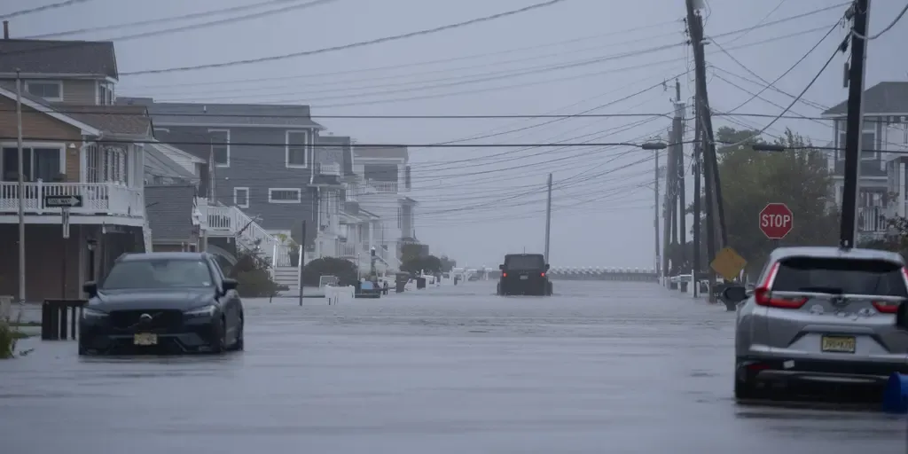
THE TAKEAWAYBoston metro and coastal Massachusetts: Pounding rain, street flooding and powerful wind gusts up to 60 mph continue. Long Island and NYC corridor: Vicious 50 mph wind gusts, driving heavy wave action along south-facing ocean beaches. Outer Banks and the Jersey Shore: Waves remain extremely high (up to 18 ft) with ongoing severe beach erosion and persistent inundation during high tide cycles. The monster nor'easter is still slamming millions as it makes a direct hit along the New Jersey coastline, lashing the East Coast from North Carolina's Outer Banks all the way up to New England with intense wind gusts, severe beach erosion and destructive high tide flooding. The storm makes its dramatic turn onshore in New Jersey today, fueling its final act of violent winds that may knock out thousands of more power outages. As a result of the deadly weather conditions, a 56-year-old man was killed by a falling tree in Brooklyn, New York, as strong winds slammed New York City and the Northeast on Saturday. Nor’easter FOX Weather Threat Zone.(FOX Weather) The nor’easter has already left behind a wide swath of damage along the East Coast, from New England to the Outer Banks.
Meet the destructive invasive species trying to get in your home this fall
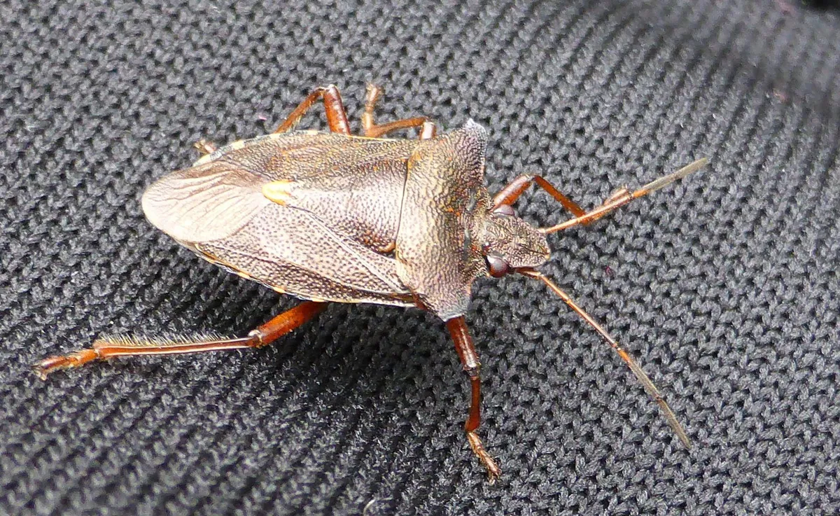
They don't bite or sting, but the brown marmorated stink bug can cause big problems. It's meteorlogical fall, and that means temperatures are starting to drop. With that, insects are looking for warm places, like your home, to hunker down for the cooler months ahead. Some of these bugs, like spiders and centipedes, likely won't come as a surprise. But others may look new to you. Take, for example, the brown marmorated stink bug. Measuring about 2 cm long and wide, with a flat, brown abdomen, it is native to Asia. It’s here in North America because it was accidentally introduced to the U. S. in 1998. "They were first detected in Ontario in 2010," Cynthia Scott-Dupree, Ph. D., a professor of sustainable pest management at the University of Guelph, told The Weather Network in 2022. "It has since become established in Ontario, Quebec, and British Columbia. "Content continues belowWhile we're focusing on this particular invasive stink bug species, there are several native stink bugs present in Ontario. Some are pests, like the brown marmorated stink bug, and other species are considered beneficial because they act like a natural biological control, hunting and consuming pest insects.
0 comments
No comments yet. Be the first to share your thoughts!