Tropical moisture fuels heavy weekend rain on the Prairies
This story deserves to be shared
Send it to someone who'd care, or post it on your networks.
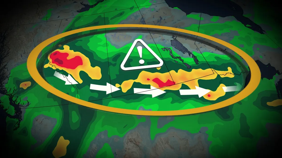
Expect widespread rain across the Prairies through your holiday weekend as a stagnant, moisture-rich pattern swings across the region. Rainfall totals of 50+ mm will affect a large swath of the region by Monday, with areas that see thunderstorm activity possibly reaching 100 mm of accumulation. DON’T MISS: Canada’s Labour Day weekend holds heavy rain and sunny skiesSeveral systems moving across the Prairies will tap into a rich reserve of moisture aloft streaming in from both the Gulf of Mexico and the Pacific Ocean, the latter of which arrives courtesy of Hurricane Marie. Rain and thunderstorms are expected in southeastern Saskatchewan and southern Manitoba through Sunday as a slow-moving low tracks along the international border. Meanwhile, another strong low-pressure system will develop along the foothills and lift north across the Prairies throughout the weekend. Significant rainfall is likely, spreading from Alberta across the southern Prairies. We could see totals of 30-50 mm in Calgary and Edmonton, with a swath of 50+ mm expected through southern portions of Saskatchewan and Manitoba.
This article is an excerpt. To read the full content, visit the original source. The Weather Network
Related articles

Flash flood threat grows as Simon's moisture fuels intense storms, slams millions across Central US
THE TAKEAWAYThunderstorms broke out across a 1,500-mile corridor from Texas to West Virginia on Wednesday. Some of the heaviest rain concentrated over parts of Central Oklahoma, including Oklahoma City, where a Level 3 out of 4 risk of flash flooding was in effect. A large dip in the jet stream is funneling moisture north from Tropical Storm Simon and will enhance storms across parts of the Central U. S. and Ohio Valley through Thursday. Storms enhanced by moisture from Tropical Storm Simon impacted millions of people across the Central U. S., churning over 1,000 miles away in the Pacific. RACHEL'S REMNANTS FUEL MAJOR WEST COAST FLOOD THREAT WITH HEAVY RAINFALL SOAKING MILLIONS Storms roll through Wichita, Kansas, on Tuesday, Oct. 13, 2026. (Gary Brown / FOX Weather)Thunderstorms capable of producing rain rates of 1 to 2 inches of rain per hour broke out across a 1,500-mile corridor, covering more than 35 million people from Texas' Big Bend region to Morgantown, West Virginia. Some of the heaviest rain concentrated over parts of Central Oklahoma, including Oklahoma City, where a Level 3 out of 4 risk of flash flooding was in effect.

Rain chances increase across central US as storm system taps Gulf moisture
Let’s take a look at how trading on prediction markets is gauging where rain or snow is most likely across the U. S. on Tuesday. Moisture from Rachel's remnants enhances storms blasting Upstate New York, New England Moisture from the remnants of Rachel, which battered Southern California over the weekend, is being carried over 3,000 miles high in the atmosphere, along a large dip in the jet stream, and is enhancing storms that are blasting parts of Upstate New York and New England Tuesday. Parts of Western and Central New York could see severe thunderstorms with damaging wind gusts and a few isolated tornadoes. Those areas, as well as parts of northern New England including Vermont, New Hampshire and Maine, could see up to 2 inches of rain through Wednesday morning. A developing storm system will trigger showers and thunderstorms from the Rockies into the Plains and Midwest, possibly bring rain to major cities in the region.
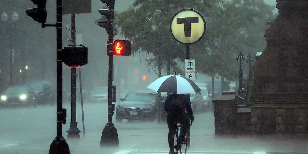
Moisture from Rachel's remnants enhances storms blasting Upstate New York, New England
"Getting Pacific moisture into New England is not unheard of, but this has tropical origins making it unique," the FOX Forecast Center said. THE TAKEAWAYMoisture associated with the remnants of former Tropical Storm Rachel has traveled from California to New EnglandParts of New England, particularly the northern portions of Vermont, New Hampshire and Maine, could see up to 2 inches of rain through Wednesday morning. A Level 1 out of 5 risk of severe storms has also been issued for parts of upstate New YorkMoisture from the remnants of Rachel, which battered Southern California over the weekend, is being carried over 3,000 miles high in the atmosphere, along a large dip in the jet stream, and is enhancing storms that are blasting parts of Upstate New York and New England Tuesday. EYE OF THE SEASON: THE MOST NOTABLE ATLANTIC HURRICANES DURING EL NIÑO YEARS🌊 UNDER WATER: Las Vegas was at the epicenter of some intense flooding Sunday as the remnants of Rachel barreled through the region. Video shows water gushing down streets and instantly flooding roadways.
Ontario’s weeks-long dry streak continues, tropical moisture may lurk
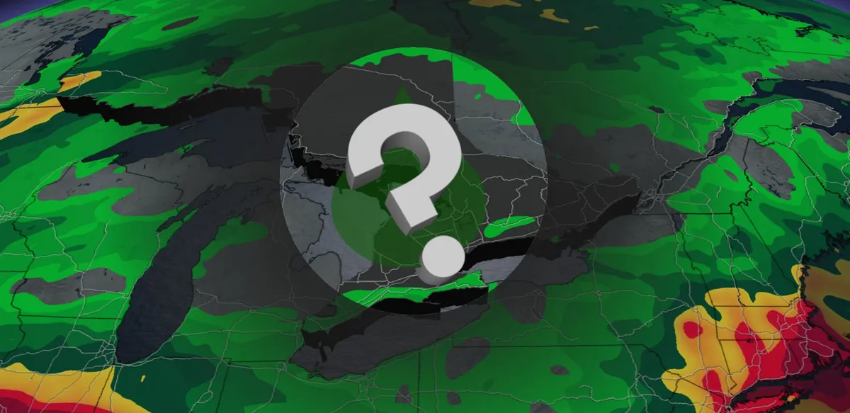
Many communities across southern Ontario are in the midst of their longest dry streaks of 2026. Expect this rain-free spell to continue for a while longer, potentially matching or besting the 16 consecutive dry days Toronto experienced in 2025. Signs of change lurk on the horizon heading into the end of next week as Hurricane Polo eventually pushes inland. DON’T MISS: El Niño could delay persistent frost and hard freezes across CanadaSeveral weeks without measurable precipitationConditions for most of September have been a welcome reprieve for southern Ontario after a damp, stormy, and rainy summer throughout the region. Persistent centres of high pressure over the Great Lakes have deflected most opportunities for precipitation; in fact, southern Ontario hasn’t seen a drop of rain since Sept. 16. We have to look back to the end of May to find the last equivalent dry streak. An average September produces about 69 mm of rain at Toronto-Pearson Airport. This month has only recorded 48.1 mm of rain, almost all of which fell during the severe thunderstorms on Sept. 2. Content continues belowSuch a spell of dry weather isn’t terribly unusual for this time of year.

Watch: Rescues unfold in New Mexico as Hurricane Polo moisture fuels statewide flood threat
THE TAKEAWAYRescue operations unfolded in Albuquerque and Mora County as flooding impacted New Mexico. The dangerous flood threat is not over, with more heavy rain possible across the state. A statewide Flood Watch remains in effect as officials warn of additional flooding. NEW MEXICO - New Mexico has been hit by dangerous flooding fueled by moisture associated with powerful Hurricane Polo, triggering several intense rescue operations as the threat continues. Pacific moisture from the monster hurricane hundreds of miles away will continue funneling into New Mexico, setting the stage for another day of potentially significant flooding across the state on Wednesday. EL NIÑO JUST BROKE A HISTORIC TEMPERATURE RECORD — AND IT’S STILL INTENSIFYINGSouthwest flood alerts.(FOX Weather) The prolonged threat is another step in a chapter of dangerous flooding that triggered numerous rescues across the state on Tuesday. Albuquerque first responders remained busy Tuesday evening as heavy rain created dangerous conditions in low-lying arroyos across the city.

Which major US cities could see rain on Tuesday as moisture fuels showers across parts of the country?
Let’s see what prediction markets, like Kalshi, are saying about the chances for rain in Miami, Phoenix and Denver on Tuesday. Several major cities across the U. S. could see rain and thunderstorms on Tuesday as moisture fuels showers across parts of the country. Miami, Phoenix and Denver are among the cities being watched for potential rainfall, with each facing a completely different weather setup. LOCAL EMERGENCY DECLARED IN CALIFORNIA BEACH CITY TO STABILIZE COASTAL BLUFFS AHEAD OF SUPER EL NIÑOAcross the Southeast, persistent easterly winds driven by an eastern U. S. heat dome will fuel daily tropical downpours across Florida through Thursday. Rain still to come across Florida.(FOX Weather) This strong onshore flow will continuously push deep Atlantic moisture inland, triggering waves of slow-moving thunderstorms with rainfall rates of 1 to 2 inches per hour along with afternoon sea breezes that will maintain a daily threat of minor flash flooding. Meanwhile, a massive heat dome over the central and eastern U. S. is blocking weather patterns, locking a relentless monsoon channel along its western edge.
0 comments
No comments yet. Be the first to share your thoughts!