Storm preparations wrap up across across the Gulf, Panhandle as Hurricane Isaias makes landfall
This story deserves to be shared
Send it to someone who'd care, or post it on your networks.
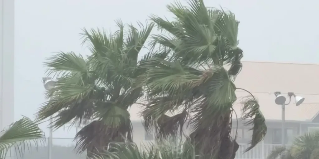
Hurricane Isaias inches closer to the Southeast, threatening the northern Gulf Coast with dangerous winds, storm surge, flooding and even tropical tornadoes as it approaches landfall as a Category 2 storm. The rapid development and strengthening of Hurricane Isaias have given millions across the Gulf Coast only days to prepare, as sandbag distributions, school closures, emergency declarations and evacuations wrap up ahead of the storm’s arrival. This comes as more than 30 million people across Florida, Alabama, Mississippi, Louisiana and Georgia are expected to experience the worst of Isaias', prompting state and local officials to take the necessary precautions well ahead of landfall on Friday. (Robert Ray / FOX Weather)FloridaGov. Ron DeSantis declared a state of emergency Tuesday for 25 Florida counties on Tuesday, allowing state agencies to position resources and prepare for potential impacts from Isaias across the Panhandle and Big Bend.
This article is an excerpt. To read the full content, visit the original source. Fox Weather
Related articles
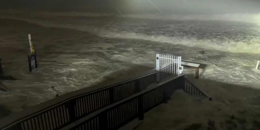
Isaias slams Florida Panhandle, but the worst may not be over as dangerous impacts spread inland
Hurricane Isaias makes landfall near Destin, Florida Hurricane Isaias has made landfall near Destin, Florida, as a Category 2 hurricane with sustained winds of 105 mph. The powerful storm is unleashing destructive winds, life-threatening storm surge and torrential rain along the Gulf Coast. DESTIN, Florida – Isaias made landfall on the Florida Panhandle just after 9 p.m. ET as a dangerous Category 2 hurricane, unleashing life-threatening storm surge and destructive winds along the northern Gulf Coast — but the threat is far from over. More than 30 million people across Florida, Alabama, Mississippi, Louisiana and Georgia are facing Isaias’ most dangerous impacts as storm surge swamps the Gulf Coast and hurricane conditions and flash flooding spread inland. WHAT IS STORM SURGE? Hurricane Isaias made landfall near Destin, Florida, around 9:30 p.m. ET, bringing maximum sustained winds of 105 mph and an estimated minimum central pressure of 971 mb. The storm has since weakened tremendously and in their 2 a.m. update, the National Hurricane Center said Isaias is now a post-tropical cyclone. Hurricane Isaias as of 9 p.m. ET NHC update.
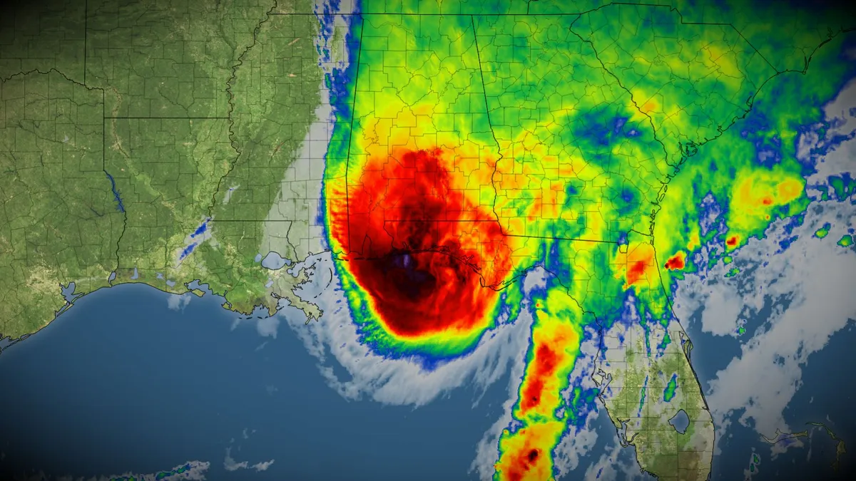
Hurricane Isaias makes landfall in Florida, Canadian impacts possible
Hurricane Isaias made landfall on the Florida Panhandle on Friday evening with damaging winds, flooding rains, and isolated tornadoes. The eye of the hurricane pushed ashore near Destin, Fla., around 9:30 p.m. EDT on Friday with maximum, sustained winds of 165 km/h, making it a Category 2 storm. A wind gust of 187 km/h was reported at Santa Rosa Sound, Fla., as the eyewall moved through the region. DON'T MISS: Canada's Winter Sneak Peek: El Niño puts record warmth in playThe storm has since been downgraded to a post-tropical cyclone. As the storm continues to push inland through the weekend, folks in the southeastern U. S. can expect more power outages and tree damage from high winds. RELATED: The curse of storm nine: Why so many “I” hurricanes are monstersRainfall totals of 100+ mm have already fallen across the Florida Panhandle. Some areas will likely see 200+ mm of rain by the end of the storm this weekend. Flash flooding is already occurring in the hardest-hit areas. A risk for tornadoes will continue through Saturday afternoon for parts of the eastern Florida Panhandle, Georgia, and the Carolinas.
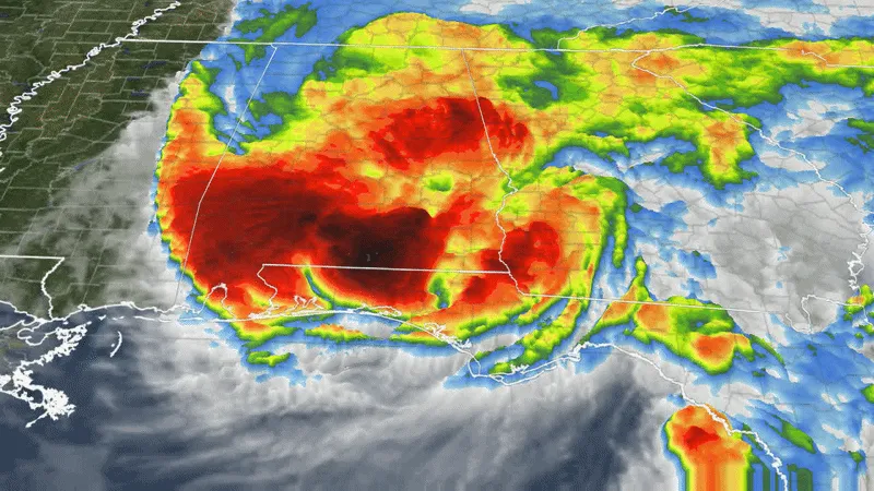
Hurricane Isaias makes landfall as a monster Category 2 storm as conditions worsen along Gulf Coast
Hurricane Isaias makes landfall near Destin, Florida Hurricane Isaias has made landfall near Destin, Florida, as a Category 2 hurricane with sustained winds of 105 mph. The powerful storm is unleashing destructive winds, life-threatening storm surge and torrential rain along the Gulf Coast. Hurricane Isaias made landfall Friday as a dangerous Category 2 storm, lashing the northern Gulf Coast with destructive winds and life-threatening storm surge. The powerful storm made landfall at 9:30 p.m. ET near Destin, Florida, with sustained winds of 105 mph and an estimated minimum central pressure of 971 mb as it moved north at 19 mph. More than 30 million people across Florida, Alabama, Mississippi, Louisiana and Georgia are expected to experience the worst of Isaias' impacts, while rain from the storm’s remnants will spread across more than 15 states in the eastern U. S. after landfall this weekend. HURRICANE ISAIAS THREATENS MORE THAN COASTLINE WITH IMPACTS TO PUSH INLAND ACROSS SOUTH Hurricane Isaias as of 9 p.m. ET NHC update. Isaias was previously a Category 3 hurricane, but as of the 8 p.m. NHC advisory, the dangerous storm has slightly weakened to a Category 2.

Bryan Norcross: Nor'easter winds down while the Atlantic is mostly quiet as Hurricane Polo heads for landfall
Hurricane Polo and Nolo continue to churn in the Pacific HURRICANE UPDATE: A parade of storms continues to brew across the Pacific as Hurricane Nolo is expected to become a major hurricane as it gradually strengthens. Meanwhile, Hurricane Polo threatens the Southwest U. S., fueling a level 3 out of 4 flood threat across more than 10 states. Updated at 12 p.m. on Sunday, Sept. 27, 2026. NOR’EASTER UPDATEThe nor'easter just offshore of the New Jersey coast is weakening. The trend will continue through the day as the system slowly moves away from New Jersey tonight. Where winds are onshore, flooding is still likely at high tide times today. Flooding is still possible in bays, harbors, and sounds where the water is trapped. Midday high tides at the western end of Long Island Sound might affect operations at LaGuardia Airport in New York, for example. NOR'EASTER TURNS DEADLY AS STORM LASHES THE EAST COAST WITH MORE DESTRUCTIVE FLOODING, VIOLENT WINDSStay aware of National Weather Service alerts for your area. Later in the day, as the winds subside, the floodwaters that have been held in place will be able to begin to drain. next SURF CITY, NEW JERSEY, USA - SEPTEMBER 26: A view of a
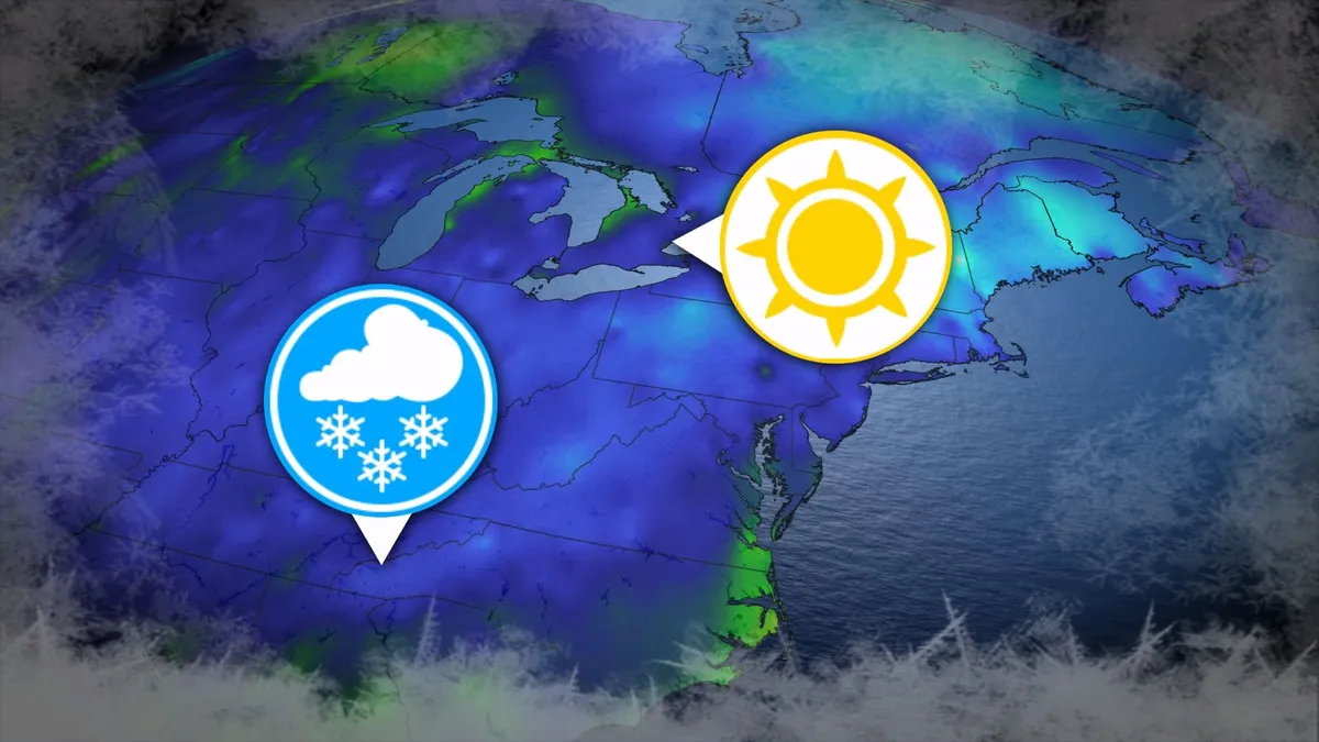
Where’s the frost? Southern U.S. hits freezing before Toronto, Montreal
Toronto and Montreal have remained above the freezing mark every day for almost six months. While frosts and even some snowflakes have intruded across parts of Ontario and Quebec in recent weeks, the two cities have yet to reach that magic number. What’s even more remarkable is that a handful of communities across the southern United States have already dipped to the freezing point--and some have even seen accumulating snowfall. DON’T MISS: Official: Canada records first -30°C reading of the seasonThe last time we saw a freezing temperature in either Toronto or Montreal was the second-to-last week of April. Toronto hit -1.3°C early on April 20, while Montreal dipped to -2.0°C the following morning. Our average first frost in both cities occurs right around the middle of October. But warmer-than-normal years can see this milestone slide several weeks past due. Montreal once had to wait 207 consecutive days for its first frost, with the city’s first subfreezing temperature in 2017 waiting until Nov. 7. The latest Toronto’s had to wait to hit the zero-degree mark was Nov. 13, 2022.
0 comments
No comments yet. Be the first to share your thoughts!