Seasonal Allergies in Canada: What to Expect This Fall
This story deserves to be shared
Send it to someone who'd care, or post it on your networks.

About 25 percent of Canadians deal with seasonal allergies. Ragweed usually dominates the headlines in the fall, but this year is different. “We do anticipate that it will be a bit of a lighter season than last year,” says Daniel Coates, Director at Aerobiology Research Laboratories. “Probably about 70 per cent of the grains that we saw last year. "DON'T MISS: Canada's 2026 fall forecast calls for a pause on cold weatherThis is excellent news for residents of Ontario, Quebec, and Manitoba, as these provinces typically experience the highest levels of ragweed pollen. However, due to the excessive rain we've seen across the country this year, the allergy season will look and feel a little different. “Ragweed and all plants do love rain, but excessive amounts of rain will wash the pollen out of the air. Allergy sufferers do not get the typical symptoms that they usually experience since the pollen has been washed down to the ground and into the sewer systems or the grass, etc.,” explains Coates. RELATED: Do I have a cold or allergies? How to tell the differnceThis phenomenon, however, does not mean allergy season is cancelled.
This article is an excerpt. To read the full content, visit the original source. The Weather Network
Related articles

Spooky and safe: Halloween decorations that won't harm wildlife
With Halloween around the corner, here are some simple swaps to make your display a treat for the neighbourhood...without tricking our wildlife. Skip the stretchy, fake spider webs outdoors. Birds and bats can get tangled in them. Try window clings or indoor webs instead. Keep lighting low and warm. Avoid bright spotlights and flashing lights, and turn decorations off overnight. Secure your decorations. Loose strings, fishing line and dangling decorations can entangle wildlife or blow away. (Marta Czurylowicz/The Weather Network)To prevent potential fires, choose battery-operated candles or lights instead of open flames. Be mindful of noise and motion. Loud, startling props can disturb animals, especially at night. Clean up daily. Pick up loose plastic, check for fallen decorations and make sure nothing has become a hazard. When you're done with those gourds, diispose of them responsibly so they don't attract wildlife, potentially putting them in harm's way on roads or in spaces near humans. The goal is to keep things spooky for the neighbours, not dangerous for nature.
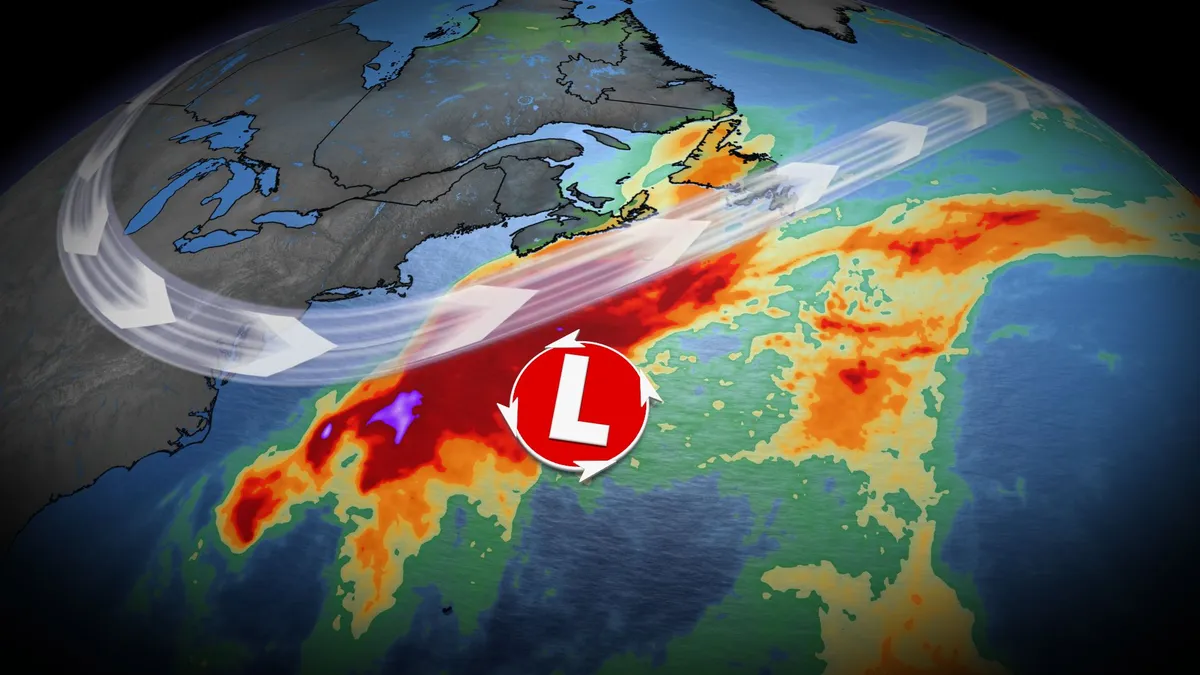
U.S. East Coast bracing for nor'easter this week. Will Canada be impacted?
Atlantic Canada may be in for a rough middle of the or late week, with forecasters keeping a close eye on the formation of a nor'easter. A non-tropical, low-pressure system between the U. S. East Coast and Bermuda will meander for the next few days, and evolve into a hybrid system with some subtropical characteristics. DON'T MISS: Canada's Winter Sneak Peek: El Niño puts record warmth in playThis system is expected to intensify, track northeast, and may become a nor’easter for Atlantic Canada late week. Widespread winds and rainy conditions, especially for eastern Nova Scotia and Newfoundland, are possible. However, there is still a high amount of uncertainty right now. Here is what we know so far. Nor'easter in development this weekThe U. S. National Hurricane Center (NHC) has a 40 per cent chance of a storm-force, non-tropical low development along a frontal boundary. The area will continue to develop and remain near stationary for the early part of this week. Strong winds and surf expected to impact parts of the U. S. Eastern Seaboard, stretching from the Carolinas to New Jersey. Most showers will remain offshore, but could clip a swath of regions from Virginia to North Carolina
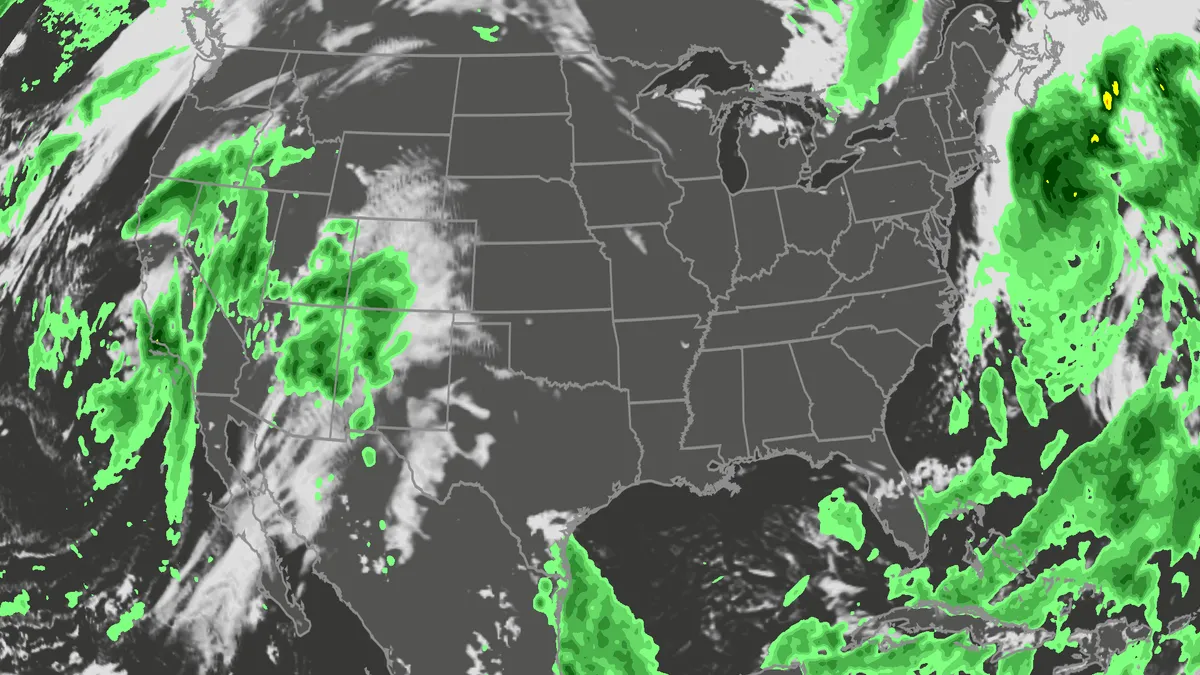
Orionid meteor shower 2026: cloud cover forecast by region
A meteor streaks across the sky over a desert in China during the Orionid meteor shower on Oct. 22, 2023.(VCG/VCG via Getty Images)The Orionid meteor shower is peaking this week, and it promises to be one of the most dazzling displays of the year. And while some of you will have clear skies, rain and clouds could impact the view for others. Here's what you need to know about the Orionids and your forecast:Fast factsPeak day: The meteor shower peaks Wednesday night, Oct. 21, into the early hours of Thursday morning, Oct. 22. Peak time: From midnight to dawn are the best hours to catch the meteors streaking through the sky, so plan on a late night or really early morning. What the Orionids are known for: The Orionid meteors are known for their brightness and their speed. As they streak across the sky at around 41 miles per second, the meteors leave behind a glowing "train" that can last several seconds to minutes. While you can make the perfect plan to catch the Orionids, the key to stellar viewing is still in Mother Nature's hands. The good news is that many of you should have good meteor shower-watching conditions. Much of the central and eastern U. S.

Can duct tape keep out flood water? Here's what lab tests found
(urbanbuzz/shutterstock)Could a cheap roll of duct tape help protect your home from flooding? New research suggests it could make a surprisingly big difference. In controlled tests, correctly applied duct tape on the outside of a household door reduced water leakage by 97-98%. The findings suggest that a simple low-cost measure could substantially reduce the amount of water entering a home during a flood. This is important as one of the key lessons from flood resilience research is that the best time to protect a property is before floodwater arrives. The UK government’s 2025 FloodReady Review called for practical, affordable measures that help households understand their risks and to prepare for flooding. And one potential contribution to this agenda might sound unlikely, at first glance. Duct tape is more commonly associated with household repairs than flood protection. However, tests colleagues and I conducted at the University of Hull demonstrated how much water can enter a property through an unprotected doorway during a flood. Three doors, ready for flood-testing.
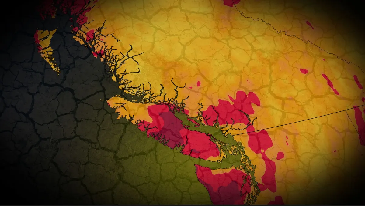
Vancouver and Victoria on track for driest October on record
Vancouver and Victoria are poised to break records this October, with both cities experiencing exceptional dryness. DON'T MISS: Canada, where did all the fall storms go? As of October 18, Vancouver has accumulated just 9.5 mm of rainfall, only 8 percent of its monthly average of 123.9 mm. Victoria has seen an even more pronounced deficit, with just 2.6 mm of rain, a mere 3 percent of its usual 96.1 mm for October. For the year overall, Victoria has received just 349.1 mm of rain, or 57 percent of its average precipitation from January to October, highlighting the persistence of this dry trend. A ridge of high pressure over the northeastern Pacific is creating a blocking pattern, steering the usual fall storm systems towards Alaska and the Yukon. This has led to a significant precipitation shortfall of 100-150 mm for B. C.’s south coast this October. While isolated showers are possible Friday and Saturday due to a weak cold front, significant rainfall is unlikely before early next week. SEE ALSO: Record fall warmth sends the mercury climbing in B. C. Long-range computer models hint at a potentially strong low pressure system developing offshore, which may bring widespread rain.
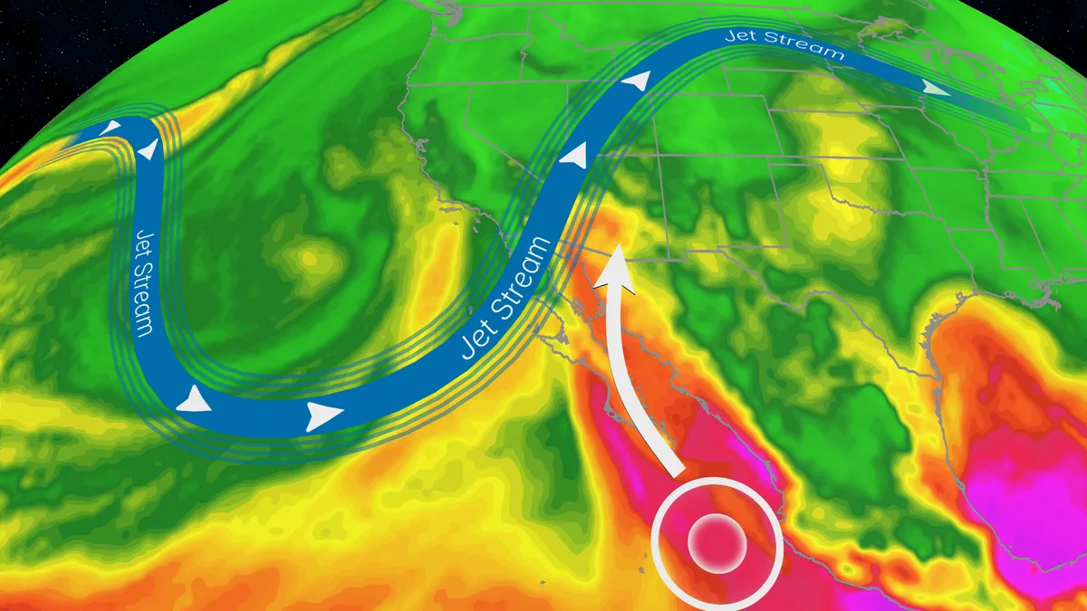
Trudy’s moisture will trigger a flood risk for Southwest US
Hurricane Trudy will bring flood threat to the Southwest USTrudy is off the Mexican coast, however, its moisture will pour into the Southwestern U. S., helping fuel a multiday flood risk across seven states this week from California to Colorado. A dip in the jet stream will also funnel in moisture from the Pacific as a strong low pressure system moves into the region. Timing out this week’s rainfallWednesday: The highest risk of flooding on Wednesday covers much of Arizona and parts of New Mexico, as well as southern portions of Colorado and Utah. There will be an abundance of moisture available to support heavy downpours and training storms. This means storms will produce heavy rain over the same areas for long periods of time. The Weather Prediction Center is forecasting rainfall rates as high as 2 inches per hour. Some of the biggest concern will be the possibility of mudslides over recent burn scar areas as well as slow canyons and arroyos. If you have plans to visit any of the national parks in the West this week, make sure you check the forecast daily and pay attention to any warnings or advisories issued.
0 comments
No comments yet. Be the first to share your thoughts!