Recalling one of the most damaging events from the hailstorm capital of Canada
This story deserves to be shared
Send it to someone who'd care, or post it on your networks.
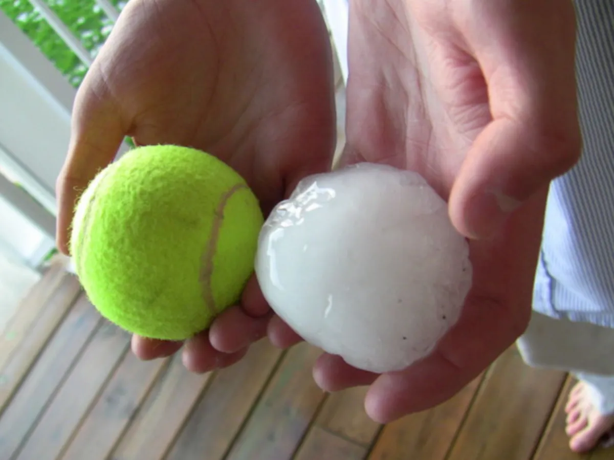
This Day In Weather History is a daily podcast by The Weather Network that features stories about people, communities, and events and how weather impacted them.--On Saturday, September 7, 1991, Calgary, Alberta, was battered with tennis ball-sized hail. The hailstorm triggered 62,000 insurance claims that added up to $342 million. Alberta isn't a stranger to strong storms and icy precipitation. Southern and central areas of Alberta are known as "Hailstorm Alley. " Aggressive storms can produce huge hailstones that often damage property.
Courtesy of TWNThe hail usually falls from High River to Red Deer and Lacombe to Rocky Mountain House. This stretch of Alberta produces some of the most intense and damaging hail in the world. Calgary is known as the "hailstorm capital of Canada. "Content continues belowAt the time, the 1991 event was the most damaging hailstorm in Canadian history, but it has since been surpassed.
This article is an excerpt. To read the full content, visit the original source. The Weather Network
Related articles
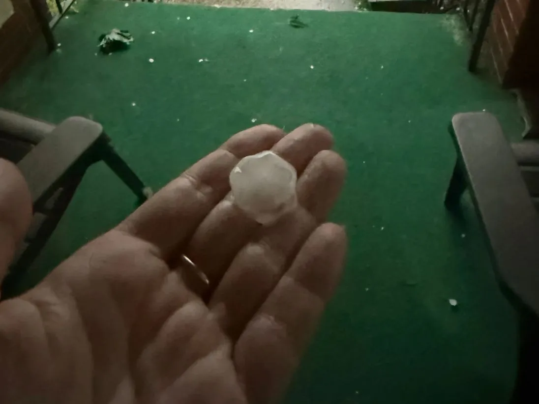
Ontario faces severe storms Wednesday with damaging winds, heavy rain, and tornado risk
Severe weather conditions shaped up across southern Ontario Wednesday, driven by an unstable, humid atmosphere, and a sharp cold front from Michigan acting as the primary trigger. All severe hazards are possible this afternoon and evening, including torrential rain, damaging winds, and very large hail (larger than golf ball-size). There is also a potential for one or two tornadoes. DON'T MISS: Summer lingers as warmth wins out across Canada in SeptemberBe sure to stay alert to the changing conditions, and check for any weather warnings in your area. Round 2: Severe and dangerous storm setupSevere storms intensified ahead of the cold front, sweeping from Barrie through the GTA and into eastern Ontario through 8 p.m. STORM TRACKING: Scenes from Ontario's thunderstroms as they unfoldRisks include torrential rain, damaging winds, large hail (greater than golf ball-size), and isolated tornadoes. Areas west of Toronto to Lake Huron and east to Bancroft-Kingston show an elevated tornado risk. Trailing storms are possible near London around the dinner hour. Content continues belowPotential impacts:Power outages and tree damage due to strong winds. Localized flooding from heavy rain.
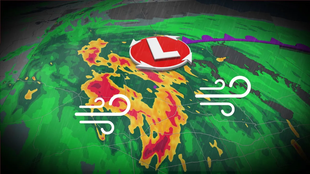
Eastern Prairies face large hail, soaking rains and damaging wind potential
After a stormy Saturday across parts of the Prairies, there will be a renewed threat for severe storms to develop throughout Sunday. In fact, multiple rounds of hazardous weather is expected from the morning to the evening in parts of Saskatchewan and Manitoba. Be sure to monitor the radar if you’ve got plans through Sunday night, and stay aware of potential watches and warnings in your area. DON’T MISS: What is a mesoscale convective system? How an 'MCS' can spell dangerSevere weather likely in multiple rounds on SundayMoisture and instability streaming over the Prairies to end the weekend will bring a fresh threat for strong to severe thunderstorms across the region. The greatest concern will exist in southern Saskatchewan into southern Manitoba, including areas around Regina and Brandon. A low over southern Saskatchewan is producing showers and thunderstorms through the morning and afternoon. Multiple rounds are expected on Sunday, with stronger storms pushing into southeastern Saskatchewan and southwestern Manitoba. Content continues belowFavourable dynamics like CAPE are providing an environment for a potent, late-season severe weather risk.
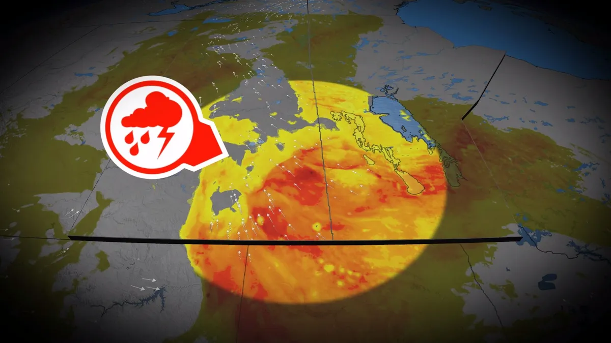
Prairie storms risk damaging winds, large hail on Sunday
A stormy Saturday spawned very large hail and rotation across parts of the Prairies. We’ll see a renewed threat for severe storms develop throughout Sunday, with multiple rounds of hazardous weather expected. Be sure to monitor the radar if you’ve got plans through Sunday night, and stay aware of potential watches and warnings in your area. DON’T MISS: What is a mesoscale convective system? How an 'MCS' can spell dangerMoisture and instability streaming over the Prairies to end the weekend will bring a fresh threat for strong to severe thunderstorms across the region. The greatest concern will exist in southern Saskatchewan into southern Manitoba, including areas around Regina and Brandon. Sunday will start with morning thunderstorms across central Saskatchewan. These cells should remain non-severe, but downpours and small hail are possible. Content continues belowStorms will organize and tap into higher instability over eastern Saskatchewan by Sunday afternoon, quickly developing into one or more lines as a low-pressure system develops near the international border. This activity will increase the potential for damaging winds and large hail in southeastern Saskatchewan.
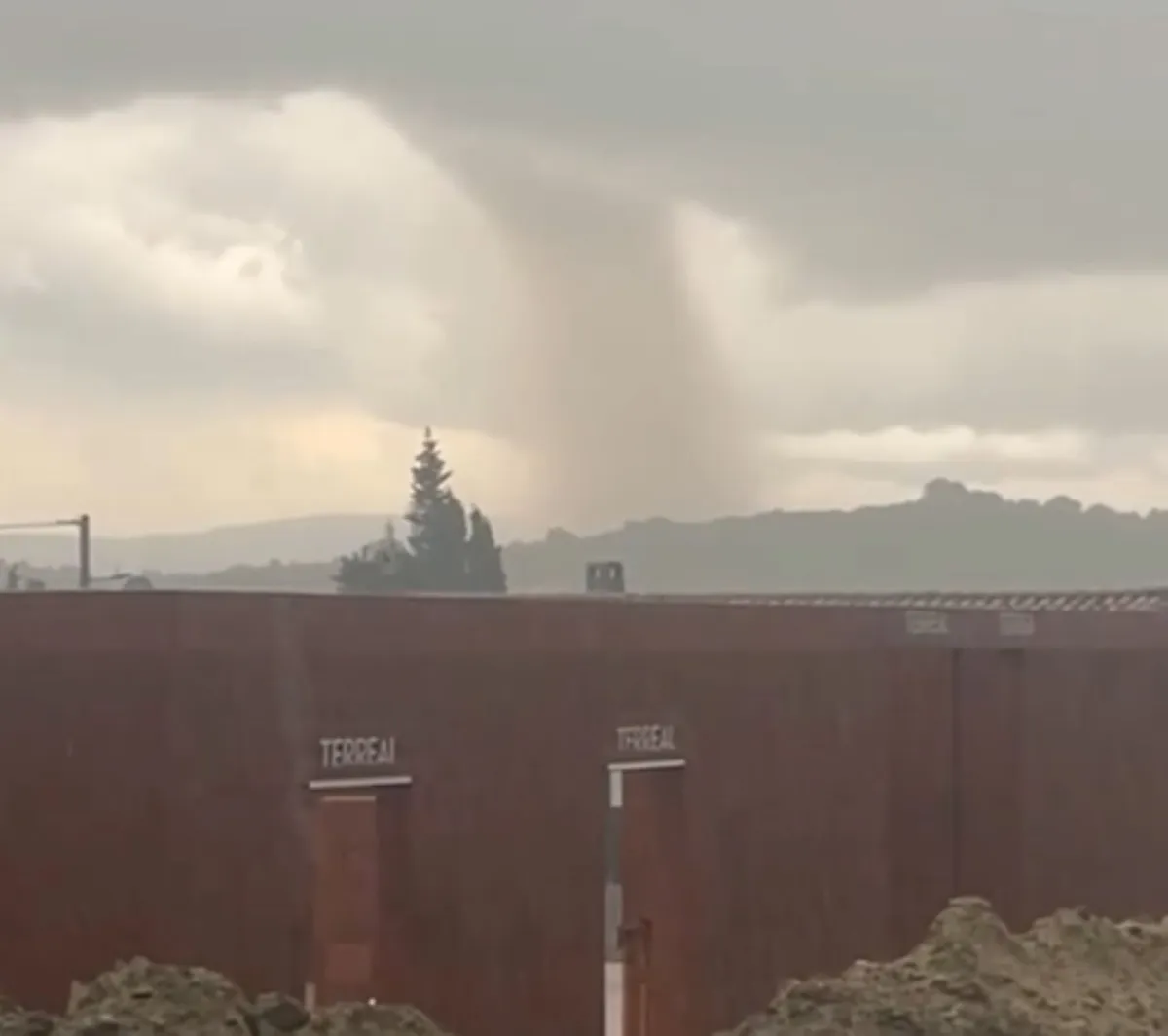
Popular spot in southern France hit by rare, damaging tornado
When word comes out about a destructive tornado, many would immediately look to a location somewhere in North America. But on Monday, southern France was the site of a damaging tornado, a rare intensity for the region--captured in videos and photos by onlookers, and posted to social media. While no injuries have been reported, several homes incurred damage and thousands are without power, according to local media accounts. As well, multiple roads were reportedly closed due to fallen trees and to allow for easier access for emergency services. Early reports and social media videos put the tornado location south of Carcassonne, France, in the Limoux-Pomas-Couffoulens corridor, during late-Monday afternoon. Significant damage to homes was reported, but results of a formal damage survey and intensity rating is still to be released. Content continues belowThe twister was created by a rotating supercell ahead of a broad complex of thunderstorms crossing Occitanie. While France records tornadoes every year, a mature, damaging supercell tornado of this intensity is rare.
0 comments
No comments yet. Be the first to share your thoughts!