Prepare for significant travel disruptions, possible power outages - The Weather Network
This story deserves to be shared
Send it to someone who'd care, or post it on your networks.
This article is an excerpt. To read the full content, visit the original source. The Weather Network
Related articles
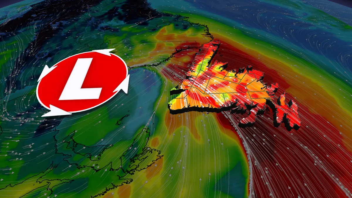
Wild Newfoundland winds of 100-120 km/h threaten power outages, damage
A low-pressure system tracking across Atlantic Canada will continue to bring potentially damaging winds and high swells on Saturday as it moves farther across Newfoundland. This system is bringing significant weather impacts, including heavy rainfall, strong winds, and high swells. Wind warnings are in effect, with the risk for power outages and disruptions to ferry services. Through 2 p.m. local time, the following wind gusts have been reported:Twillingate: 115 km/hBonavista: 112 km/hSagona Island: 101 km/hGander: 87 km/hSt. John’s: 82 km/hVisit our Complete Guide to Fall 2026 for an in depth look at the Fall Forecast, tips to plan for it and much more! Stay updated with the latest information on this developing system, and any weather warnings in your area. Damaging wind threat SaturdayThe primary concern on Saturday will be strong winds, particularly for Newfoundland’s northern coast, where wind gusts between 110-120 km/h are forecast. Wind warnings are in effect for Saturday in the region, with St. John’s set to experience its windiest day since May 13.
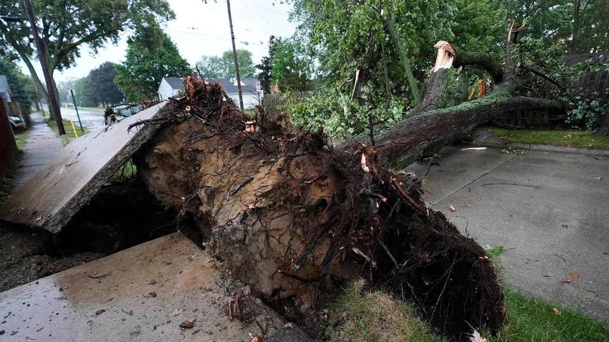
Detroit hit by first tornado since 1997; power outages top 250,000
Tornado hits metro Detroit, leaving thousands without powerA confirmed tornado ripped through the Detroit metro area Thursday evening, as severe storms slammed Michigan and left more than 250,000 homes and businesses without power by Friday morning. Survey teams from the National Weather Service concluded that the damage was from a tornado, Detroit's first since 1997. Hundreds of trees were toppled across dozens of neighborhoods. The tornado-warned storms slashed across multiple counties, including Macomb, Oakland, Livingston and Washtenaw. Residents shared photos and videos on social media of massive trees that crashed onto homes and cars. No major injuries were reported. The east side of Detroit took the brunt of the storms. Mayor Mary Sheffield toured the city Thursday evening, saying there was significant damage to homes and businesses. The Detroit News reported that the storms interrupted the first day of the Michigan State Fair in Novi. People ran to their cars as rain hit the fairgrounds, and fair officials ordered people to take shelter inside an expo hall.
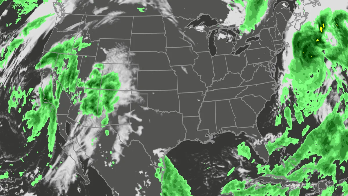
Orionid meteor shower 2026: cloud cover forecast by region
A meteor streaks across the sky over a desert in China during the Orionid meteor shower on Oct. 22, 2023.(VCG/VCG via Getty Images)The Orionid meteor shower is peaking this week, and it promises to be one of the most dazzling displays of the year. And while some of you will have clear skies, rain and clouds could impact the view for others. Here's what you need to know about the Orionids and your forecast:Fast factsPeak day: The meteor shower peaks Wednesday night, Oct. 21, into the early hours of Thursday morning, Oct. 22. Peak time: From midnight to dawn are the best hours to catch the meteors streaking through the sky, so plan on a late night or really early morning. What the Orionids are known for: The Orionid meteors are known for their brightness and their speed. As they streak across the sky at around 41 miles per second, the meteors leave behind a glowing "train" that can last several seconds to minutes. While you can make the perfect plan to catch the Orionids, the key to stellar viewing is still in Mother Nature's hands. The good news is that many of you should have good meteor shower-watching conditions. Much of the central and eastern U. S.
0 comments
No comments yet. Be the first to share your thoughts!