Northeast Ohio Weather: Humid, Isolated Showers — June 11, 2026
This story deserves to be shared
Send it to someone who'd care, or post it on your networks.
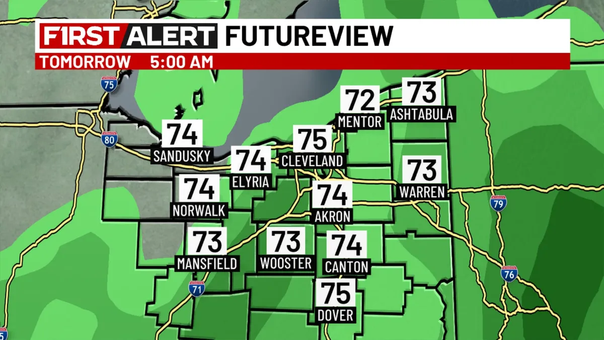
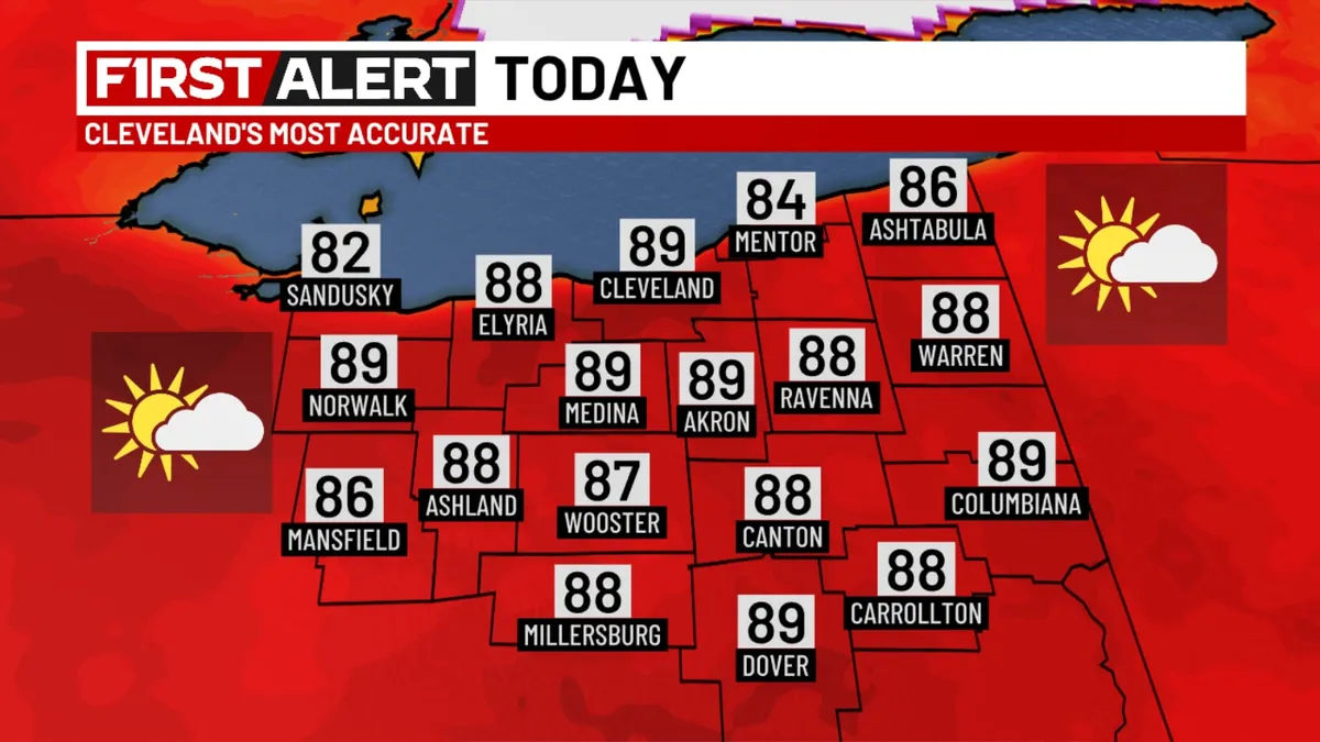
CLEVELAND, Ohio (WOIO) - A boundary will spark a few showers moving through the region this afternoon. Most locations stay dry as high temperatures reach the upper 80s. The humidity remains elevated, so “feels like” temperatures will be in the 90s. A few showers are possible overnight as a dying storm complex enters the region from the west. Low temperatures stay in the 70s. Download the 19 First Alert Weather AppGet More of Our News on GoogleSet The Weather Company as a 'Preferred Source' to get quicker access to the news you value. On Friday, a stray shower or two is possible in the morning, otherwise cloud cover decreases throughout the day. Humidity drops considerably as high temperatures hover in the 70s. Saturday will be dry and sunny as high temperatures reach the mid and upper 80s. Showers and storms are likely again on Sunday, followed by much cooler temperatures with much lower humidity Monday through Wednesday.
This article is an excerpt. To read the full content, visit the original source. The Weather Channel
Related articles
Northeast Ohio Weather: Warm, Humid Week Ahead — June 9, 2026
CLEVELAND, Ohio (WOIO) - A series of fronts will be stalled near the region this week. As moisture increases, this means higher humidity but also numerous opportunities for showers and storms. A few showers may develop late tonight and move into the area, however, overall impact for most will be quite low. Low temperatures hover in the 70s overnight. Download the 19 First Alert Weather AppFor Tuesday, a couple showers are possible in the morning before scattered thunderstorms form during the afternoon. Get More of Our News on GoogleSet The Weather Company as a 'Preferred Source' to get quicker access to the news you value. High temperatures rise to the mid 80s. In fact, afternoon temperatures pretty much reach the 80s through the end of the week, but exact readings will depend on coverage and timing of storms. Storm coverage through Friday remains scattered, meaning some locations may receive frequent downpours while others come up with little to no rain. The weather team will continue to provide updates on exact details as new data becomes available. The weekend starts with drier and a bit more refreshing conditions on Saturday followed by renewed rain chances on Sunday.

Northeast Ohio Weather: Cooler, Less Humid — June 12, 2026
CLEVELAND, Ohio (WOIO) - Cooler and less humid air is building into the area today. The next cold front tracks through Sunday. Gradual clearing today. Afternoon temperatures 76 to 82 degrees. A clear sky tonight. Download the 19 First Alert Weather AppMostly sunny tomorrow. High temperatures in the 80s. A mild Saturday night with a partly cloudy sky. Overnight temperatures fall to around 70 degrees. Get More of Our News on GoogleSet The Weather Company as a 'Preferred Source' to get quicker access to the news you value. Thunderstorms in the area Sunday.
Oh, what a tropical night in the Maritimes as humid air mass sinks in
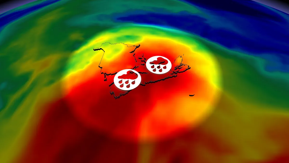
The dew points on Monday were raising eyebrows, spilling into the low 20s across most of Atlantic Canada. Dew points above 20°C can be uncomfortable for some individuals. DON’T MISS: Trouble may lurk beyond hurricane season’s very quiet startHigh dew points are often a precursor to incredibly mild nights, and that’s exactly what’s on tap through the pre-dawn hours on Tuesday. It’s also a recipe for dense fog, which may be hazardous to drivers all along Nova Scotia, the Bay of Fundy, and portions of Newfoundland through Tuesday. And all this excess moisture makes it easier to generate thunderstorms. Muggy air, rain, storm risk Monday nightAfter recent torrential rains and moisture from the subtropics, you can trace the current air mass that’s surrounding Atlantic Canada back to the Bahamas--more than 3,000 kilometres away from Newfoundland. With a highly unusual amount of moisture, thunderstorm risk continues across eastern Nova Scotia and Newfoundland through the pre-dawn hours on Tuesday. Monday overnight lows are forecast to remain at or above 20°C for Sydney and Cape Breton, N. S., Gander, St. John’s, N. L., and most of Newfoundland.

A Worrying New Trait Has Appeared in an Isolated Cat Species on a Japanese Island - ScienceAlert
On a small, isolated island of Japan, lives a tiny population of Tsushima leopard cats (Prionailurus bengalensis euptilurus). With only around 100 individuals believed to exist, they're considered critically endangered there. Recently, scientists have noticed a new trait emerging in the island's leopard cats that could mark a worrying trend for conservation efforts. During field observations in 2024 and 2025, researchers spotted three leopard cats with much shorter tails, around half the usual average length – a feature that's never been reported in this, or any other, population of leopard cats. "The occurrence of tail abnormalities in multiple individuals makes independent acquired causes, such as traumatic injuries, a less parsimonious explanation for all cases and raises the possibility of a shared heritable or developmental basis," researchers write in a new study. A short-tailed leopard cat photographed on a camera trap in Tsushima. (Ministry of the Environment, Tsushima Wildlife Conservation Center)Where these short tails are common, however, is in domestic cats (Felis catus) – a known presence in Tsushima.
Where’s the frost? Southern U.S. hits freezing before Toronto, Montreal
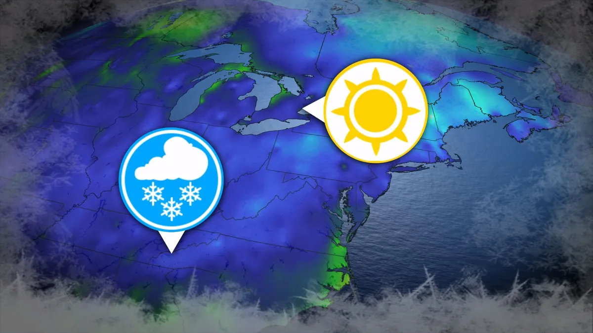
Toronto and Montreal have remained above the freezing mark every day for almost six months. While frosts and even some snowflakes have intruded across parts of Ontario and Quebec in recent weeks, the two cities have yet to reach that magic number. What’s even more remarkable is that a handful of communities across the southern United States have already dipped to the freezing point--and some have even seen accumulating snowfall. DON’T MISS: Official: Canada records first -30°C reading of the seasonThe last time we saw a freezing temperature in either Toronto or Montreal was the second-to-last week of April. Toronto hit -1.3°C early on April 20, while Montreal dipped to -2.0°C the following morning. Our average first frost in both cities occurs right around the middle of October. But warmer-than-normal years can see this milestone slide several weeks past due. Montreal once had to wait 207 consecutive days for its first frost, with the city’s first subfreezing temperature in 2017 waiting until Nov. 7. The latest Toronto’s had to wait to hit the zero-degree mark was Nov. 13, 2022.
0 comments
No comments yet. Be the first to share your thoughts!