How Anticipatory Action helps people prepare as extreme weather strikes - UN World Food Programme
This story deserves to be shared
Send it to someone who'd care, or post it on your networks.
This article is an excerpt. To read the full content, visit the original source. UN World Food Programme
Related articles

Anticipatory climate litigation: A new role for climate science? - Nature
IntroductionIn 2021, civil society actors and citizens for the first time successfully took a carbon major to court over its contribution to climate change. The main plaintiff Milieudefensie (Friends of the Earth Netherlands) argued that the failure of Royal Dutch Shell to plan for significantly reducing the future greenhouse gas emissions of its corporate group violated its duty of care under Dutch law (Giabardo, 2021; Hösli, 2021; Macchi and van Zeben, 2021). Interpreting Shell’s responsibility in light of international climate change law, human rights law, and corporate responsibility, the District Court of the Hague in the Netherlands unexpectedly allowed the case to proceed and issued an order for Shell to cut the corporation’s overall emissions by 45 percent by 2030 as compared to 2019 (Mayer, 2022). In November 2024, the Court of Appeal in The Hague overturned the decision that Shell should follow a specific reduction obligation, but confirmed that a carbon major like Shell can be held legally responsible under Dutch tort law for contributing to climate change.
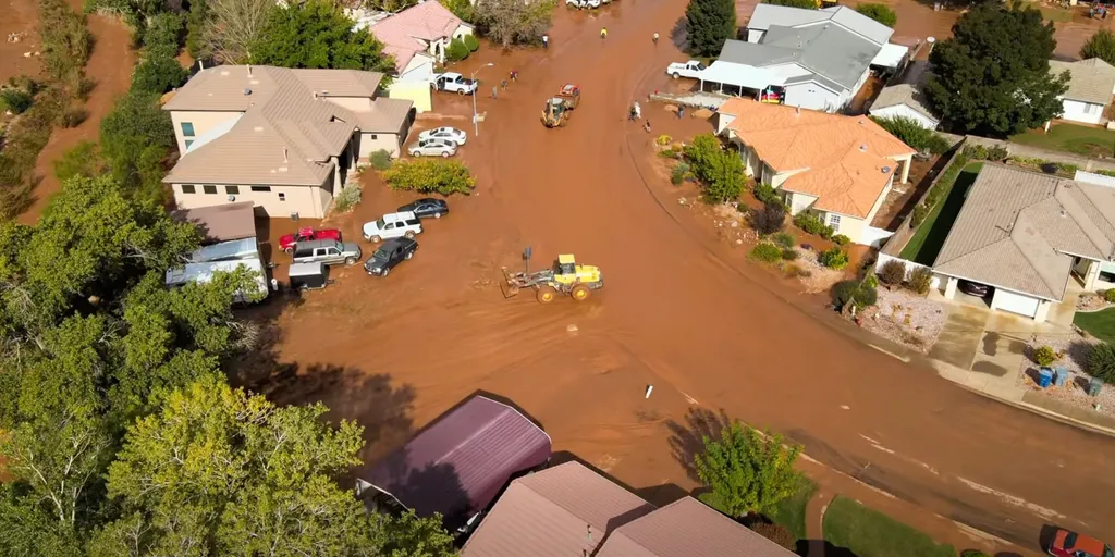
See it: Utah city forced to evacuate immediately as dangerous flash flooding inundates the region
THE TAKEAWAY: Life-threatening flash flooding inundates Hurricane, Utah. Residents living near Gould Wash were forced to evacuate immediately. City officials issued a Proclamation of Local Emergency to address the ongoing flooding. Evacuation orders were issued for residents in Hurricane, Utah, on Thursday as life-threatening flash flooding slammed the city. WHAT IS A SUPERCELL THUNDERSTORM? Residents living near Gould Wash were forced to evacuate immediately as floodwaters inundated the area. Hurricane experienced substantial flooding after more than an inch of rain fell in 12 hours. (Paul Canfield / FOX Weather)The typically dry region was transformed by the heavy rainfall, with floodwaters turning streets into rushing waterways. HOW HIGH PRESSURE AND LOW PRESSURE DRIVE THE WEATHER"Hurricane City crews and emergency response partners have been actively responding to significant flooding and related infrastructure damage throughout the community," Hurricane City Emergency Services said in a press release. City officials issued a Proclamation of Local Emergency on Thursday to address the ongoing flooding and assess the damage.
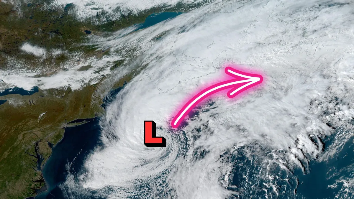
Powerful ex-Josephine threatens heavy rain, wicked winds
Atlantic Canada may be in for a rough second half of the week, with forecasters keeping a close eye on the system formerly known as Subtropical Storm Josephine. The storm has been meandering up the Eastern Seaboard this week as a powerful low-pressure system. DON'T MISS: Canada's Winter Sneak Peek: El Niño puts record warmth in playThe system will swipe southern Atlantic Canada with potent wind gusts, heavy rainfall, snowfall and three- to five-metre waves along the coastal areas, elevating the risk of flooding. Low-pressure systems exist on a spectrum between tropical and extratropical (non-tropical). Josephine has slipped across the spectrum in both directions several times over the past week. Originally a strong nor’easter, the system evolved into a subtropical storm on Wednesday before returning to its roots on Thursday. A subtropical storm is one that has characteristics of both a tropical and extratropical system, a sort of hybrid storm that can bring hazardous weather to the affected regions. Content continues belowWhile this is no longer a named storm, it will still pack hazardous winds and heavy rainfall across the region.
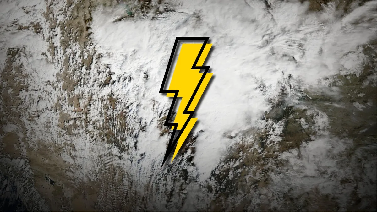
Rare tornadic setup covers desert cities again on Thursday
An unusually potent threat for severe weather covers portions of the U. S. Southwest again on Thursday, bringing a second day of severe storms to the region. Thursday’s severe weather risk is a continuation of the same setup that brought the region multiple reports of rotation and hail the size of golf balls and larger on Wednesday. DON’T MISS: Canada records its northernmost tornado in nearly 50 yearsThe atmospheric setup over this desert region is more akin to what you’d expect to see on the Plains or the Prairies. An upper-level trough swinging across California brought the lift needed to spark thunderstorms amid enhanced instability and moisture. Strong wind shear aloft has allowed thunderstorms to turn severe, with some organizing into supercells capable of producing very large hail, damaging wind gusts, and tornadoes. Wednesday’s storms prompted widespread severe thunderstorm and tornado warnings across Arizona and Utah. Storm chasers reported several potential tornadoes in the region, and one report came in of hail up to 5 cm (2 in.) in diameter northwest of Phoenix. Content continues belowA similar setup on Thursday prompted the U. S.
0 comments
No comments yet. Be the first to share your thoughts!