GPs explain why your hands and feet swell in warm weather - The Independent
This story deserves to be shared
Send it to someone who'd care, or post it on your networks.
This article is an excerpt. To read the full content, visit the original source. The Independent
Related articles

Say goodbye to wet feet: Waterproof your shoes with this simple hack
Heavy rain can create messy situations. As someone who knows the weather, I have some seriously waterproof boots that even Moses would envy. But if all you have are sneakers, don't worry - there's a solution to keep your feet dry. All you’ll need is a candle and a hair dryer. The first step is to rub the candle wax all over the shoe. Then, simply turn on the blow dryer and let the melting begin. No life hack video is complete without a test. Check out the video above to see how effective this one was. Looking for more life hacks? Check out the ones below:Never scrape your windshield again with this sandwich bag hackHow to make your own windshield washer fluid using simple ingredientsWhy you should never throw silica packets awayWhat to do with leftover bubble wrapDon’t throw your stale cookies away — this hack helps bring freshness backTransform your broken umbrella with this clever hackWindows fogging up? Try this simple hack using table saltThis simple move may save many kids' lives during a heat wave

Warnings persist as high winds, heavy snow hit the Prairies
Steady snowfall will continue for a wide swath of the Prairies as a blustery low-pressure system continues trekking across the region. Calgary picked up measurable snowfall early Friday. Additional accumulations are likely toward the east, with some areas on the northern Prairies picking up as much as 50 cm of snow. Warnings remain in effect for both high winds and winter storm conditions. PHOTOS: Burst of October snow falls over major Canadian citiesThe large low-pressure system responsible for the early dose of wintry weather will continue lifting north as we head into Saturday, bringing heavy snowfall to the north and blowing snow to southern regions. Wind gusts of 50-80+ km/h will persist through Saturday across Saskatchewan and Manitoba, easing into the overnight hours. Sudden reductions in visibility are expected late Friday into early Saturday across southern Saskatchewan as brief but intense snowfall accompanies the gusty winds in the region. Content continues belowRELATED: What’s the snowiest month in your corner of Canada? High snowfall rates will continue into the weekend across northern portions of Saskatchewan and Manitoba, including Cree Lake and Black Lake.
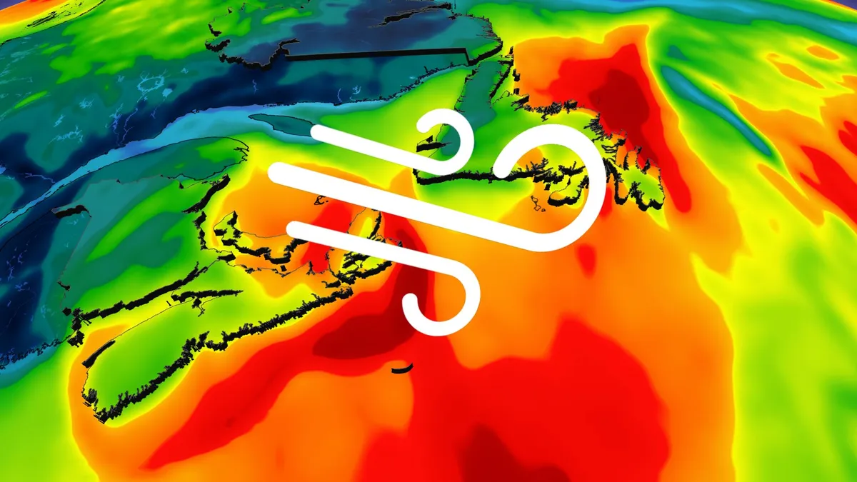
Ex-Josephine brings high winds and maybe snow to East Coast
Parts of Atlantic Canada may be in for a rough start to the weekend, with forecasters keeping a close eye on the system formerly known as Subtropical Storm Josephine. The storm has been meandering up the Eastern Seaboard this week as a powerful low-pressure system but has now reached cold North Atlantic waters. DON'T MISS: Canada's Winter Sneak Peek: El Niño puts record warmth in playThe system will swipe southern Atlantic Canada with potent wind gusts, heavy rainfall, snowfall and three- to five-metre waves along the coastal areas, elevating the risk of flooding. Low-pressure systems exist on a spectrum between tropical and extratropical (non-tropical). Josephine has slipped across the spectrum in both directions several times over the past week. Originally a strong nor’easter, the system evolved into a subtropical storm on Wednesday before returning to its roots on Thursday. A subtropical storm is one that has characteristics of both a tropical and extratropical system, a sort of hybrid storm that can bring hazardous weather to the affected regions.
0 comments
No comments yet. Be the first to share your thoughts!