Final Polar Vortex Split: Late-Winter Stratospheric Wind Reversal is Coming, Impacting the Weather into March - Severe Weather Europe
This story deserves to be shared
Send it to someone who'd care, or post it on your networks.
This article is an excerpt. To read the full content, visit the original source. Severe Weather Europe
Related articles
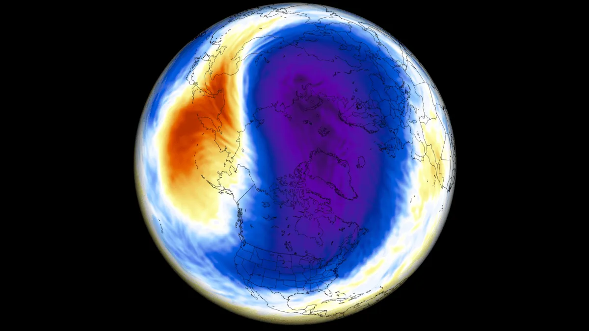
A New Polar Vortex Is Emerging Over the North Pole, With a Winter 2026/2027 Disruption Risk
A new Polar Vortex is now forming over the North Pole, with rapid stratospheric cooling and a pressure drop already visible in the latest data. It is starting the season stronger than last year, but the long-range forecasts show a very different signal for Winter 2026/2027. New seasonal trends agree on a notable slowdown of the Polar Vortex around mid-winter, with weakening winds and rising pressure in the stratosphere. A strong Super El Niño is also developing in the Pacific, adding another factor affecting the Polar Vortex winter development. In this article, I will look at the new Polar Vortex development from Fall to Winter 2026/2027, the Super El Niño connection, and what a major disruption or a Polar Vortex collapse would bring for winter weather across the United States, Canada, and Europe. To keep it simple, the Polar Vortex is the broad winter circulation over the Northern (and Southern) Hemispheres. You can imagine the Polar Vortex as a spinning wall over the polar regions, rising from the surface into the stratosphere (over 50 km/ 30 miles high), keeping the cold polar air inside.
0 comments
No comments yet. Be the first to share your thoughts!