Evacuations ongoing, states of emergency declared ahead of future Hurricane Isaias’ dangerous landfall
This story deserves to be shared
Send it to someone who'd care, or post it on your networks.
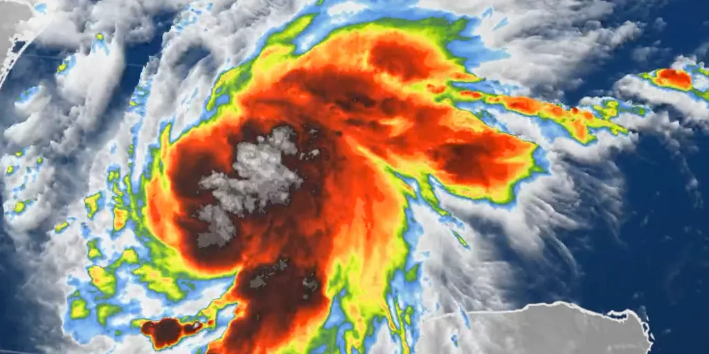
THE TAKEAWAYTropical Storm Isaias has formed in the southern Gulf and is forecast to strengthen into a hurricane before making landfall along the northern Gulf Coast later this week. A Hurricane Warning is in effect from Ocean Springs, Mississippi, to the Bay/Gulf County Line in Florida. Heavy rain is expected to begin on Friday, with flash flooding, damaging wind gusts, potentially life-threatening storm surge and even tornadoes possible as the storm comes ashore. Landfall is currently expected sometime between late Friday and early Saturday, but uncertainty remains regarding exactly where and how strong Isaias will be at that time. Hurricane and Storm Surge Warnings have been issued for the northern Gulf Coast as Tropical Storm Isaias continues to strengthen in the southern Gulf and is forecast to rapidly intensify into a dangerous Category 2 hurricane. HOW ARE HURRICANES RATED? Isaias is expected to approach the coast by Friday, with landfall currently estimated to be sometime late Friday or early Saturday between Gulfport, Mississippi, and Panama City, Florida. Isaias stats(FOX Weather) Florida Gov. Ron DeSantis and Alabama Gov.
This article is an excerpt. To read the full content, visit the original source. Fox Weather
Related articles
Santa Ana winds boost danger as fires prompt evacuations
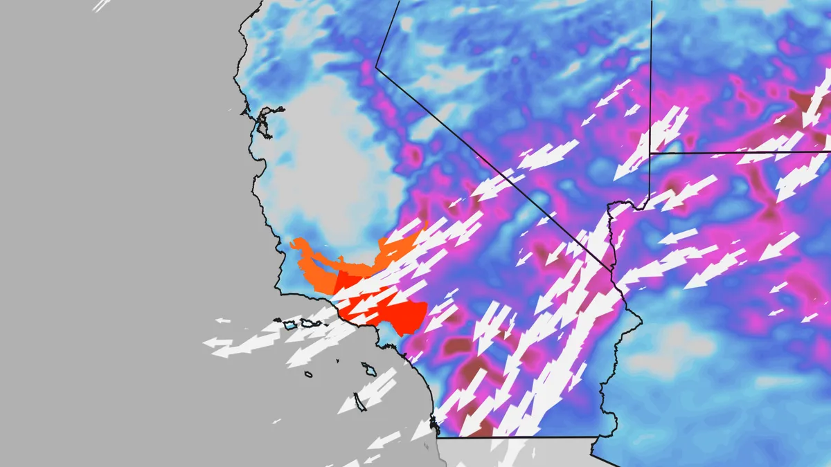
California's first Santa Ana wind event of the fall will wrap up this weekend. Gusty winds blasting the Los Angeles Basin increase the threat for rapidly spreading wildfires. Parts of Southern California and the Sierra Nevada could still see pockets of gusty winds, hot temperatures and dry air Sunday. (MORE: What are Santa Ana winds, and why are they so dangerous?)Here's the latestSeveral brush fires burn in Southern California Saturday, including the Bryson Fire, which has burned nearly 150 acres as of Saturday afternoon. The Norte Fire in Orange County, California, which has already impacted several homes, has burned over 500 acres. The Henderson Fire in San Diego County has burned over 3,000 acres and is 20% contained, also as of Saturday afternoon. Firefighters worked to contain two other fires that had sparked Thursday afternoon and triggered evacuation orders in the city of Azusa, north of L. A., and Camp Pendleton near San Diego, The Associated Press reported. Preparation for impacts — including damage to trees and power lines, blown away lawn furniture and holiday decorations and potential fire growth — should be rushed to completion.
Evacuations underway as Bouquet Fire rapidly spreads, encroaching on homes in Los Angeles County
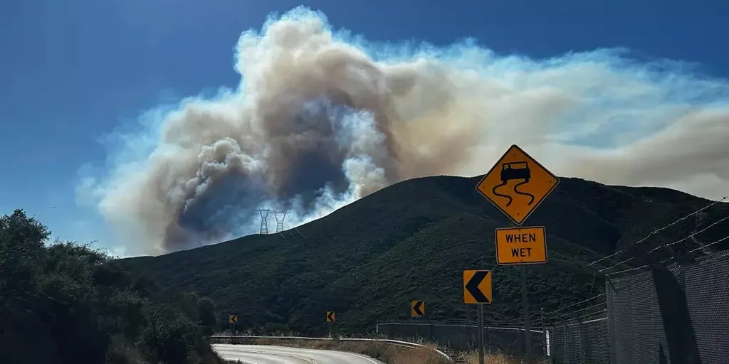
The Bouquet Fire broke out in the Angeles National Forest around 3:30 p.m., quickly growing from 20 acres to 1,000 overnight. THE TAKEAWAYA wildfire has scorched over 1,000 acres in Angeles National Forest. The fire — coined the Bouquet Fire — broke out Saturday evening. People in the Santa Clarita area were ordered to evacuate as the wildfire spreads. LOS ANGELES COUNTY, Calif. - Evacuations are underway after a wildfire broke out in Los Angeles County on Saturday evening, quickly growing to over 1,000 acres, according to local fire officials. CAL FIRE said the fire, coined the Bouquet Fire, broke out in the Angeles National Forest around 3:30 p.m., quickly growing from 20 acres to 1,000 overnight. MEET THREEHALVES: THE VIRAL ROBOT DESIGNED FOR EARTH'S MOST DANGEROUS ENVIRONMENTSJust before 5 p.m., the fire had already spread to over 700 acres. In their most recent update, the Angeles National Forest said Bouquet Canyon Road remains closed from Spunky Canyon to Vasquez Canyon. Evacuations are ongoing, with officials saying the Bouquet Fire is threatening structures and power lines. Firefighters said the blaze is 40% contained.
New Mexico flooding pushes dam to the brink, forcing evacuations
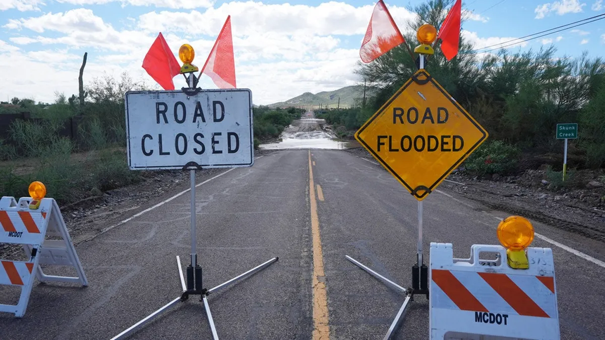
Watch drivers fight through dangerous New Mexico flash floodsHundreds of people from at least five communities in southern New Mexico were ordered to evacuate their homes as flash floods pushed the McLeod Dam to the brink of failure. People in Salem, Garfield, Hatch and Placitas were able to return to their homes late Tuesday night, but officials in Doña Ana County said Rincon remains evacuated. The National Weather Service issued an urgent warning for people to seek higher ground Tuesday afternoon, as operators of the dam reported its imminent failure and potentially life threatening flooding downstream. Stunning video showed the floodwaters overtopping the dam on Tuesday afternoon. (MORE: Flood threat expands into Texas)Local news reports showed washed out roads across Doña Ana County, and officials begged residents to avoid driving if possible. Get More of Our News on GoogleSet The Weather Company as a 'Preferred Source' to get quicker access to the news you value. Gavin Smith, a Garfield resident, told The Associated Press that he and others had initially left the area before returning to assess conditions.
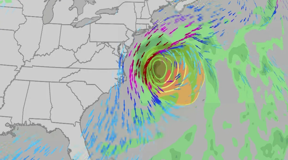
Nor' easter to bring coastal flooding, winds to East Coast
An October nor'easter is developing in the Atlantic, where it will bring high surf, rip currents, coastal flooding, winds and rain to parts of the East Coast for several days this week. The National Hurricane Center has it highlighted as an area to watch this week for potential subtropical development. However, regardless of development, this system will bring dangerous conditions to the East Coast this week. Fortunately, this system doesn't look to be as strong as the one in September. But the bad news? It could linger for much of the week, so impacts could have a longer duration than you would think. There are currently coastal flood alerts across parts of coastal North Carolina and Virginia, where anywhere from 1 to 4 feet of inundation is possible. Key takeawaysWe do not expect this storm to be as strong as the late September nor'easter. The area most likely impacted the longest appears to be from the Delmarva Peninsula to eastern North Carolina, with more models pointing to primarily eastern North Carolina.
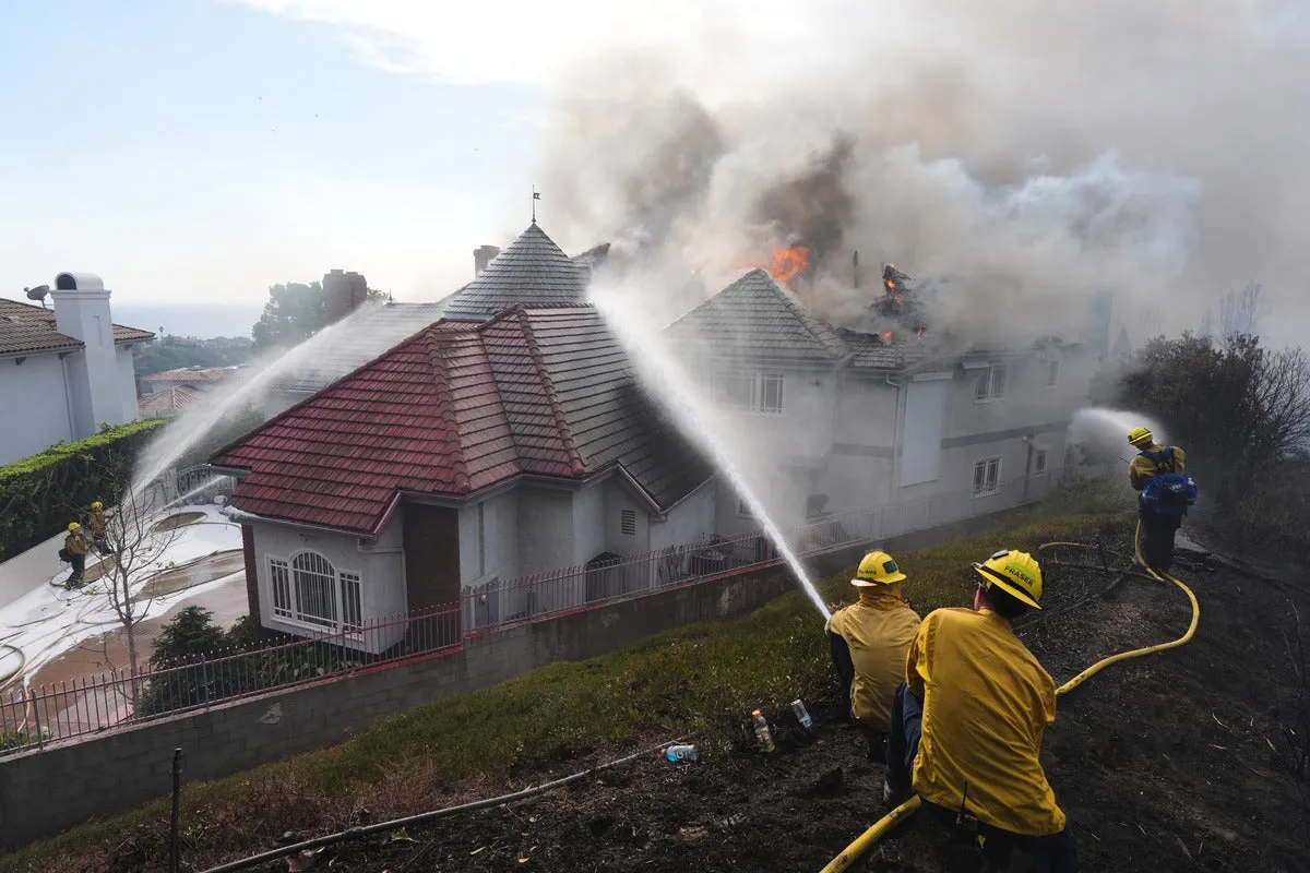
Coastal homes burn as hot winds fuel California wildfires
Thousands evacuate Southern California as wind-fueled fires burn homesFire crews in Southern California gained ground Saturday on a wind-driven blaze that charred hills and damaged or destroyed at least six large coastal homes, allowing evacuation orders to be lifted and thousands of people to return home. The fast-moving Norte Fire sparked the previous day in San Clemente amid hot, strong Santa Ana winds that drove it into San Juan Capistrano, prompting the evacuation of about 16,000 residents. Firefighters work to douse a house fire during the Norte Fire on Friday, Oct. 16, 2026, in San Juan Capistrano, Calif.(AP Photo/Jae C. Hong)Hundreds of firefighters deployed to combat the blaze in the hills of Orange County. At one home engulfed in smoke and fire, photos showed them using hoses to try to douse the flames. Most of the evacuations were lifted Saturday evening, except for one street in San Clemente. The Norte Fire was one of several in the region hit by the Santa Anas, which blow from the interior and toward the coast.

Meet the marine technician documenting Antarctica's beauty while protecting its future
Marine technician crosses world's roughest sea to document AntarcticaFor Andrew Naslund, Antarctica is his “favorite place in the world.”He’s a marine technician for Scripps Institution of Oceanography. And while not a professional photographer, he’s capturing Antarctica’s beauty along his research journey. Andrew Naslund, Scripps Institution of Oceanography marine technician.(Andrew Naslund)The researchNaslund spends months aboard a research vessel, the R/V Roger Revelle (AGOR 24), which he describes as “basically a floating laboratory.”“The purpose of this ship is to provide a platform for scientists to reach some of the most remote reaches of our oceans,” Naslund said. A big part of his role is assisting the scientists to safely deploy and recover their instrumentation over the side of the ship. He also keeps track of incoming data, ensuring the scientists are getting the information that they came out there to get. “[We’re] a mobile weather station. So anywhere that we travel in the world, we’re collecting meteorological weather data,” he says.
0 comments
No comments yet. Be the first to share your thoughts!