Central Atlantic low could become Tropical Storm Fay
This story deserves to be shared
Send it to someone who'd care, or post it on your networks.
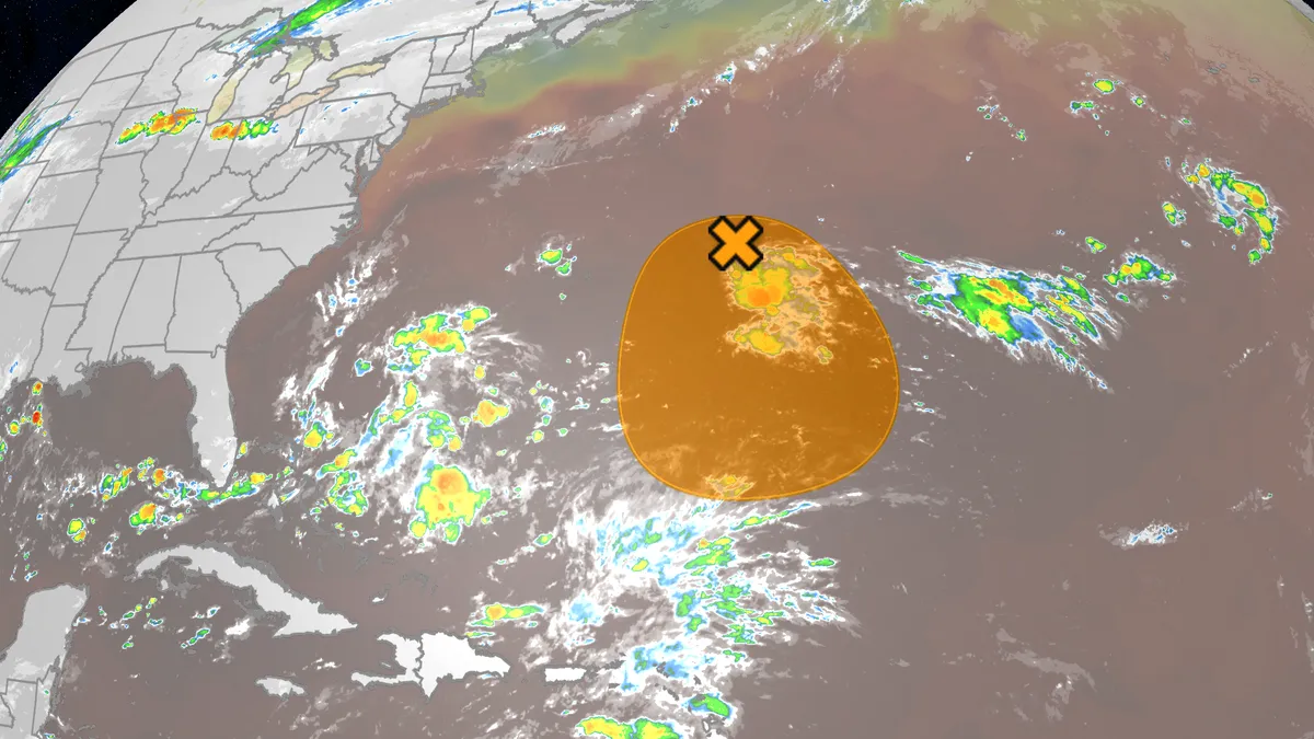
The 2026 Atlantic hurricane season has been the least active season in over 75 years, but there is an area we're watching for possible development the next few days. Where is it now? This small area of low pressure is over 300 miles east of Bermuda. Disorganized thundershowers are being affected by some northerly wind shear, blowing those showers away from the swirl of low pressure. The National Hurricane Center is calling this low "Invest 98L," a naming convention they use to identify systems of interest and allow higher-resolution computer forecast models to be run on them. (MORE: What is an Invest?)What could happen? This low is expected to loaf around the central Atlantic Ocean the next few days, drifting southward a bit. Get More of Our News on GoogleSet The Weather Company as a 'Preferred Source' to get quicker access to the news you value. While it's experiencing wind shear now, it's in a pocket where relatively shear lower. The challenge it faces is that once it drifts farther south, it could face even more wind shear. You can see this in the map below in the pink and maroon colors south of the "X" and blob denoting the system.
This article is an excerpt. To read the full content, visit the original source. The Weather Channel
Related articles
Atlantic's hurricane-free streak in jeopardy. Could Fay be the first?
With a little more than two months still to go in the Atlantic season (Nov. 30), we still are awaiting the first hurricane, an occurrence that already has set a record for the latest in the year (if it does happen). There are multiple factors in why there has been no hurricane, yet, but can at least be partly blamed on a "super" El Niño in progress. During typical El Niño years, hurricane development is usually surpressed given the amount of wind shear present in the Atlantic basin. Still, though, it is odd that we haven't seen a single hurricane at this point in the season. There is still plenty of time left in the 2026 season, but with the climatological peak in the rearview mirror (Sept. 10), is it possible we could see a hurricane-less Atlantic this year? Well... Fay forms with an outside chance of reaching hurricane statusAs of Sept. 20, there have been six recorded tropical storms and zero hurricanes. Content continues belowWe do have a new tropical storm in the Atlantic basin, with forecasters now eyeing a chance it could approach or reach hurricane status. (NOAA/NASA)Fay came to fruition in the Atlantic basin early Sunday, but the storm poses no threat to land.
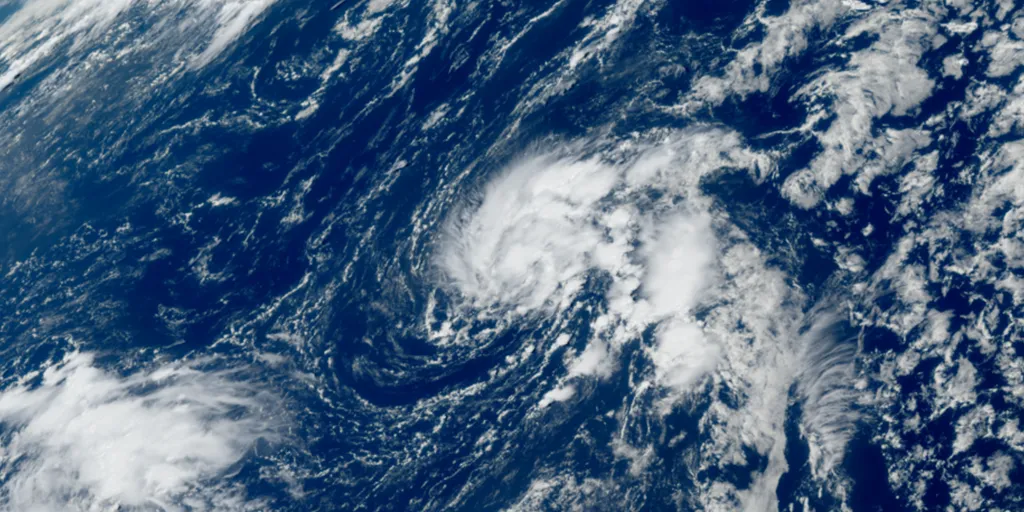
Tropical Storm Fay starts to intensify after forming in the Atlantic amid brewing Super El Niño
The system is not expected to impact land, according to the FOX Forecast Center. THE TAKEAWAYTropical Storm Fay, formerly Tropical Depression Six, has formed in the Atlantic Ocean. The Atlantic hurricane season is off to its quietest start on record, dating back to the beginning of the satellite era (1960). Fay is expected to ultimately encounter hostile conditions and eventually fizzle out, but not before strengthening in the next day or so. Tropical Storm Fay has started to intensify after forming in the Atlantic Ocean, southwest of the Azores, packing winds of 60 mph. According to the National Hurricane Center (NHC), Tropical Storm Fay is slow-moving at 3 mph and is forecast to move southwest across the Atlantic Ocean. WHAT IS A TROPICAL STORM? The latest on Tropical Storm Fay in the Atlantic. The storm, formerly known as Tropical Depression Six, is forecast to meander through the weekend before a dip in the jet stream approaches from the east, steering the system south into the central Atlantic next week. WHAT’S THE DIFFERENCE BETWEEN A TROPICAL DEPRESSION, TROPICAL STORM AND HURRICANE? According to the FOX Forecast Center, the system is not expected to impact land.
Orionid meteor shower 2026: cloud cover forecast by region
A meteor streaks across the sky over a desert in China during the Orionid meteor shower on Oct. 22, 2023.(VCG/VCG via Getty Images)The Orionid meteor shower is peaking this week, and it promises to be one of the most dazzling displays of the year. And while some of you will have clear skies, rain and clouds could impact the view for others. Here's what you need to know about the Orionids and your forecast:Fast factsPeak day: The meteor shower peaks Wednesday night, Oct. 21, into the early hours of Thursday morning, Oct. 22. Peak time: From midnight to dawn are the best hours to catch the meteors streaking through the sky, so plan on a late night or really early morning. What the Orionids are known for: The Orionid meteors are known for their brightness and their speed. As they streak across the sky at around 41 miles per second, the meteors leave behind a glowing "train" that can last several seconds to minutes. While you can make the perfect plan to catch the Orionids, the key to stellar viewing is still in Mother Nature's hands. The good news is that many of you should have good meteor shower-watching conditions. Much of the central and eastern U. S.

Can duct tape keep out flood water? Here's what lab tests found
(urbanbuzz/shutterstock)Could a cheap roll of duct tape help protect your home from flooding? New research suggests it could make a surprisingly big difference. In controlled tests, correctly applied duct tape on the outside of a household door reduced water leakage by 97-98%. The findings suggest that a simple low-cost measure could substantially reduce the amount of water entering a home during a flood. This is important as one of the key lessons from flood resilience research is that the best time to protect a property is before floodwater arrives. The UK government’s 2025 FloodReady Review called for practical, affordable measures that help households understand their risks and to prepare for flooding. And one potential contribution to this agenda might sound unlikely, at first glance. Duct tape is more commonly associated with household repairs than flood protection. However, tests colleagues and I conducted at the University of Hull demonstrated how much water can enter a property through an unprotected doorway during a flood. Three doors, ready for flood-testing.
Trudy’s moisture will trigger a flood risk for Southwest US
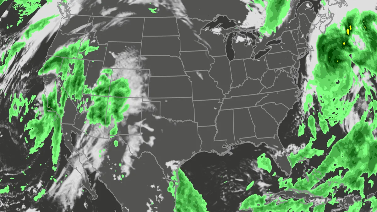
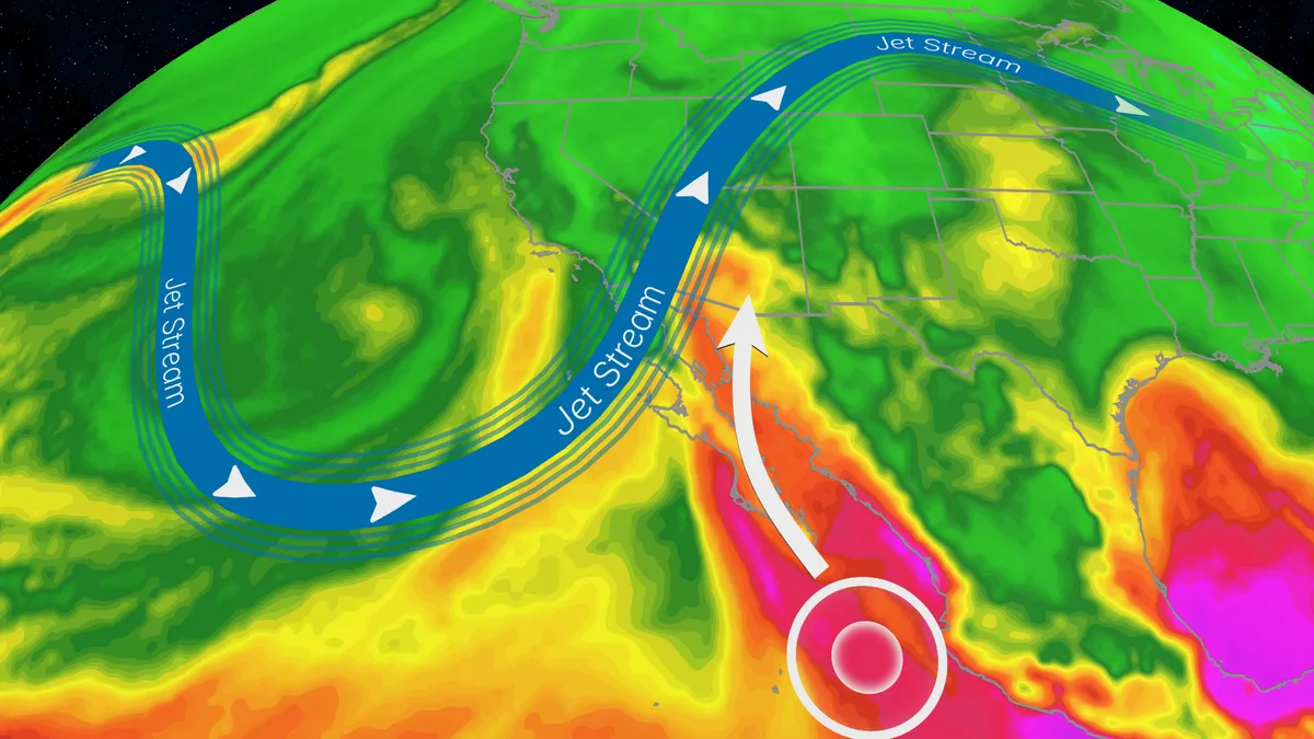
Hurricane Trudy will bring flood threat to the Southwest USTrudy is off the Mexican coast, however, its moisture will pour into the Southwestern U. S., helping fuel a multiday flood risk across seven states this week from California to Colorado. A dip in the jet stream will also funnel in moisture from the Pacific as a strong low pressure system moves into the region. Timing out this week’s rainfallWednesday: The highest risk of flooding on Wednesday covers much of Arizona and parts of New Mexico, as well as southern portions of Colorado and Utah. There will be an abundance of moisture available to support heavy downpours and training storms. This means storms will produce heavy rain over the same areas for long periods of time. The Weather Prediction Center is forecasting rainfall rates as high as 2 inches per hour. Some of the biggest concern will be the possibility of mudslides over recent burn scar areas as well as slow canyons and arroyos. If you have plans to visit any of the national parks in the West this week, make sure you check the forecast daily and pay attention to any warnings or advisories issued.
Nor' easter to bring coastal flooding, winds to East Coast
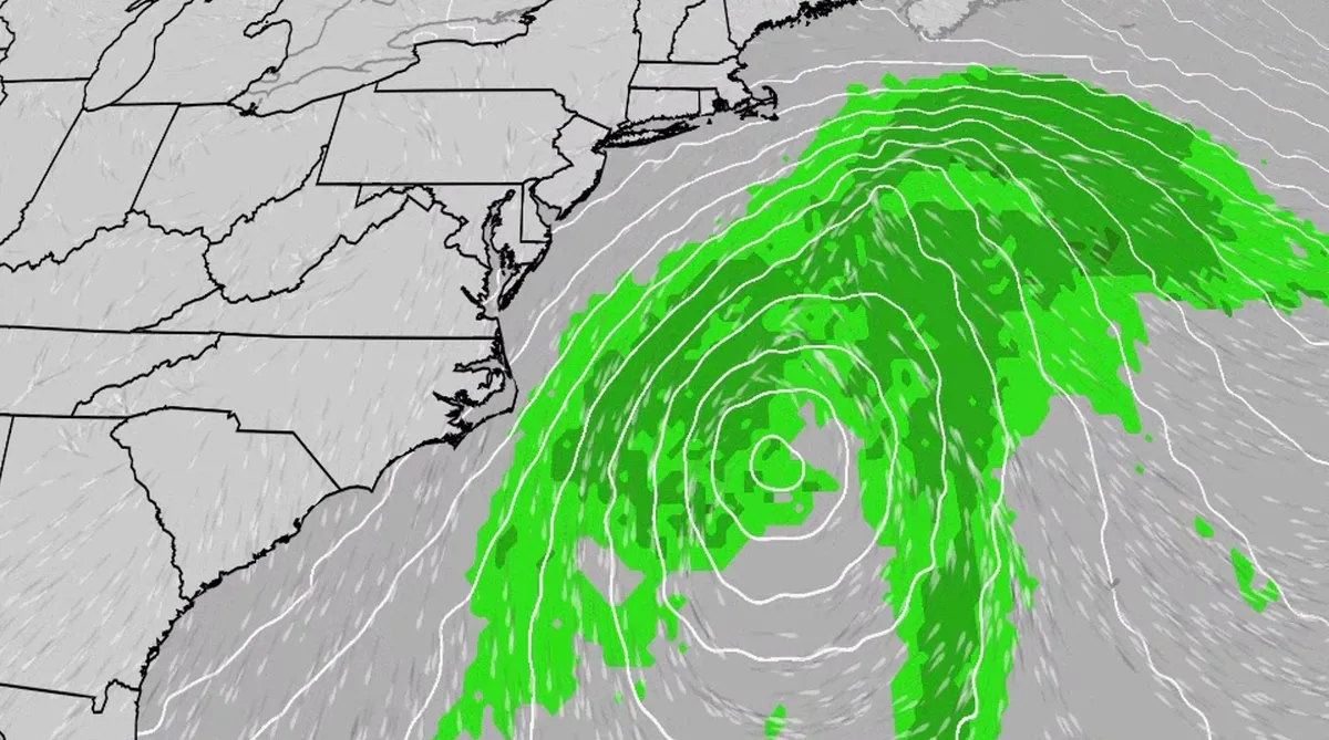
An October nor'easter is developing in the Atlantic, where it will bring high surf, rip currents, coastal flooding and winds to parts of the East Coast for several days this week. The National Hurricane Center has highlighted it as an area to watch this week for the potential development of Josephine. However, regardless of whether we call this system a nor'easter or Josephine, the impacts will be the same. The bottom line: This system will bring dangerous conditions to the East Coast for multiple days this week.(MORE: What is a nor'easter?)Fortunately, this nor'easter doesn't look to be as strong as the one in September. But the bad news? It could linger for much of the week, so impacts could have a longer duration. Coastal flood alerts are in effect for parts of coastal North Carolina and Virginia, where anywhere from 1 to 4 feet of inundation is possible. Get More of Our News on GoogleSet The Weather Company as a 'Preferred Source' to get quicker access to the news you value. Key takeawaysWe do not expect this storm to be as strong as the late September nor'easter.
0 comments
No comments yet. Be the first to share your thoughts!