Another milestone for the future of European weather observation - European Space Agency
This story deserves to be shared
Send it to someone who'd care, or post it on your networks.
This article is an excerpt. To read the full content, visit the original source. European Space Agency
Related articles

Champi kills 1 and injures 350 in Taiwan overnight
Typhoon Champi sends towering waves over Taiwan harborChampi has killed one person and injured hundreds in Taiwan and has downed trees and knocked out power for hundreds of thousands of people. The storm's strong winds and rains continued overnight Friday into Saturday morning. ImpactsAlthough the storm is no longer a typhoon, it was the equivalent of a Category 3 Atlantic hurricane when it grazed Taiwan. Champi did not hit Taiwan directly, but the storm's span was large enough to impact most of Taiwan. The island's weather authorities said the storm was weakening Saturday morning and that by evening, the land warnings for the typhoon would be removed.(MORE: Hurricane Vance intensifies rapidly off Mexico's Pacific Coast)Taiwan’s Central Emergency Operations Center reported that 350 people were injured as of Friday night. The one death was a man who was washed away by waves in Taiwan’s Pingtung County, the island’s southernmost part. Power outages, canceled flightsThe storm knocked out power for 280,000 households, according to United Daily News, a local Taiwanese newspaper, citing the island's power authorities. But power had returned to 80% of households by Saturday morning.

Hurricane Vance intensifies rapidly off Mexico's Pacific Coast
This GOES-19 GeoColor satellite image provided by the National Oceanic and Atmospheric Administration (NOAA) and taken on Friday, Oct. 23, 2026, shows Hurricane Vance in the Pacific.(NOAA via AP)Hurricane Vance rapidly strengthened into a Category 2 storm Friday as it neared Mexico’s Pacific Coast, the National Hurricane Center said. Vance had maximum sustained winds of 110 mph as it churned about 385 miles south-southwest of Acapulco, according to an advisory from the Miami-based hurricane center. The storm was nearing major hurricane strength, the center said, though gradual weakening was expected to start by Saturday.(MORE: Typhoon Champi sends towering waves over Taiwan harbor)The hurricane's outer bands were already funneling gale-force winds and rough seas into Mexico's Gulf of Tehuantepec, the center said. An unusually busy Pacific hurricane seasonIt’s been an intense hurricane season in the Pacific Ocean, with storms spawning in assembly-line fashion near Hawaii and Mexico as El Niño conditions create unusual weather, like this week's severe flooding and tornadoes hitting the southwestern United States and the prolonged drought in Central America's Dry Corridor.

Hunter's Moon: When and where to see October's full moon
October’s full moon, known as the “Hunter’s moon” is coming this weekend, but weather might make the view a hit or miss for some areas. The full moon peaks late Sunday night, or early Monday morning, for anyone in the Eastern Daylight Time Zone: EDT: 12:12 am (Monday)CDT: 11:12 pm (Sunday)MDT: 10:12 pm (Sunday)PDT, MST: 9:12 pm (Sunday)Whether or not the weather will let you see the full moon is another question. A large cold front and developing low pressure system stretching across the middle third of the country will create less than ideal viewing conditions for the Plains and Upper Midwest. The Pacific Northwest is facing a similar problem with a storm system moving in from the Pacific Ocean. A super moon but not a supermoonIf you manage to get outside to view the full moon, you might describe the experience as “super”, but it is not in fact a supermoon. A supermoon happens when the moon is full at the same time as it is at its perigee, or the point in its orbit closest to the Earth. Get More of Our News on GoogleSet The Weather Company as a 'Preferred Source' to get quicker access to the news you value. The next two supermoons happen on Nov. 24 and Dec. 24.

Ask a met: How can you know if a cloud is forming or dissipating?
"I've always been curious how you can determine if a cloud is forming or if a cloud is dissipating. Do clouds form over the course of several hours? How long do they last? " —RubenFirst of all, thank you for your cloud question! If you’ve been around weather.com, you likely know that I love talking about all things clouds. In order to tell if a cloud is forming versus dissipating, there are a few visual cues you can look for — keeping in mind that not all cloud types behave exactly the same. Clouds that are forming typically have more defined, crisp edges and are growing in size. On the other hand, more fuzzy looking edges as well as flattening or spreading out are all indicators that the cloud is dissipating. You’ll want to make sure to observe the clouds for several minutes before coming to a conclusion because clouds are constantly changing shapes and you don’t want to be fooled. Get More of Our News on GoogleSet The Weather Company as a 'Preferred Source' to get quicker access to the news you value. To your next question, clouds can actually form much more quickly than you might think.

Warnings persist as high winds, heavy snow hit the Prairies
Steady snowfall will continue for a wide swath of the Prairies as a blustery low-pressure system continues trekking across the region. Calgary picked up measurable snowfall early Friday. Additional accumulations are likely toward the east, with some areas on the northern Prairies picking up as much as 50 cm of snow. Warnings remain in effect for both high winds and winter storm conditions. PHOTOS: Burst of October snow falls over major Canadian citiesThe large low-pressure system responsible for the early dose of wintry weather will continue lifting north as we head into Saturday, bringing heavy snowfall to the north and blowing snow to southern regions. Wind gusts of 50-80+ km/h will persist through Saturday across Saskatchewan and Manitoba, easing into the overnight hours. Sudden reductions in visibility are expected late Friday into early Saturday across southern Saskatchewan as brief but intense snowfall accompanies the gusty winds in the region. Content continues belowRELATED: What’s the snowiest month in your corner of Canada? High snowfall rates will continue into the weekend across northern portions of Saskatchewan and Manitoba, including Cree Lake and Black Lake.
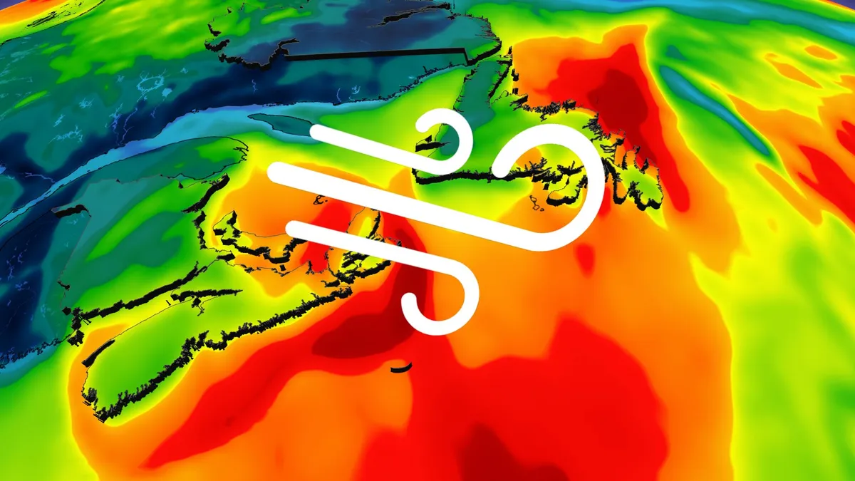
Ex-Josephine brings high winds and maybe snow to East Coast
Parts of Atlantic Canada may be in for a rough start to the weekend, with forecasters keeping a close eye on the system formerly known as Subtropical Storm Josephine. The storm has been meandering up the Eastern Seaboard this week as a powerful low-pressure system but has now reached cold North Atlantic waters. DON'T MISS: Canada's Winter Sneak Peek: El Niño puts record warmth in playThe system will swipe southern Atlantic Canada with potent wind gusts, heavy rainfall, snowfall and three- to five-metre waves along the coastal areas, elevating the risk of flooding. Low-pressure systems exist on a spectrum between tropical and extratropical (non-tropical). Josephine has slipped across the spectrum in both directions several times over the past week. Originally a strong nor’easter, the system evolved into a subtropical storm on Wednesday before returning to its roots on Thursday. A subtropical storm is one that has characteristics of both a tropical and extratropical system, a sort of hybrid storm that can bring hazardous weather to the affected regions.
0 comments
No comments yet. Be the first to share your thoughts!