40 car pileup cripples commute in South Carolina with dense fog reported in the area
This story deserves to be shared
Send it to someone who'd care, or post it on your networks.

Officials have not said whether fog directly contributed to the crash, but the FOX Forecast Center reports evidence of foggy conditions in the area.
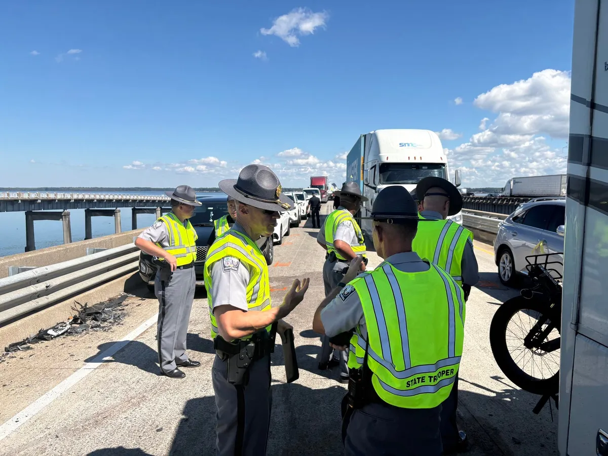
LAKE MARION, S. C. – Officials are assessing the damage after a massive pileup on Interstate 95, near Lake Marion, South Carolina, occurred after numerous cars crashed due to foggy weather conditions. The pileup caused massive delays for hundreds of drivers in the area. Officials have not said whether fog directly contributed to the crash, but the FOX Forecast Center reports evidence of dense fog in the area that could have reduced visibility and may have contributed to the crash. Crews work to clear mangled vehicles after a large pileup along a highway in South Carolina. As many as 40 vehicles are involved in the pileup, with no injuries or fatalities reported so far, according to the Santee Fire District Service. The area will continue to see patchy fog conditions through Friday evening, according to the National Weather Service. RESPONDERS RESCUE DRIVER STRANDED ON TOP OF SUBMERGED CAR AS STRONG FLOODWATERS FLOW THROUGH ARIZONA next
This article is an excerpt. To read the full content, visit the original source. Fox Weather
Related articles

Pileup accident in heavy fog closes major U.S. interstate
Heavy fog likely contributed to a major pileup accident on Interstate 95 in South Carolina on Thursday. Several dozen vehicles were reportedly involved in the chain-reaction accident on the I-95 southbound bridge over Lake Marion. RELATED: It’s not your imagination—here’s why fall is the foggiest season“All I-95 southbound lanes across Lake Marion in Clarendon County are closed due to a multi-vehicle crash,” the South Carolina Dept. of Transportation posted on Thursday. The agency added: “A detour is in place beginning at mile marker 102.”There were no immediate reports of casualties related to the incident. Reduced visibility due to fog, snow, rain, or dust is the leading cause of pileup crashes. These incidents unfold rapidly. Content continues belowIf you’re ever involved in a chain-reaction accident, remaining in your vehicle is the safest thing you can do. If you have to get out, quickly move as far away from the scene as safety allows. WATCH: What causes roads to ice over almost instantly?
Dense fog triggers massive pileup on South Carolina interstate
South Carolina Highway Patrol troopers discuss plans for clearing an I-95 bridge after a 40-vehicle pileup.(Photo courtesy of SCHP Trooper Nick Pye)A massive pileup is causing major traffic issues for travelers on Interstate 95 in South Carolina. The collision occurred Thursday morning when dense fog was causing low visibility. "Fog over Lake Marion formed near first light Thursday morning, then mixed out by around 10 a.m.," said Jonathan Belles, senior digital meteorologist for The Weather Company. "Visibility dropped below a quarter of a mile at times. "The pileup has prompted a long closure of the southbound lanes of I-95 on the bridge over Lake Marion, located about an hour east of Columbia. Local news media outlets have reported estimates between 40 and 65 vehicles were involved. One reported that four people were trapped in their vehicles, and about 11 people were taken to the hospital with minor injuries. Officials warned it would take “an extended period of time” to clear the bridge. Get More of Our News on GoogleSet The Weather Company as a 'Preferred Source' to get quicker access to the news you value.
Prepare for the fall's first foggy, frosty morning commute
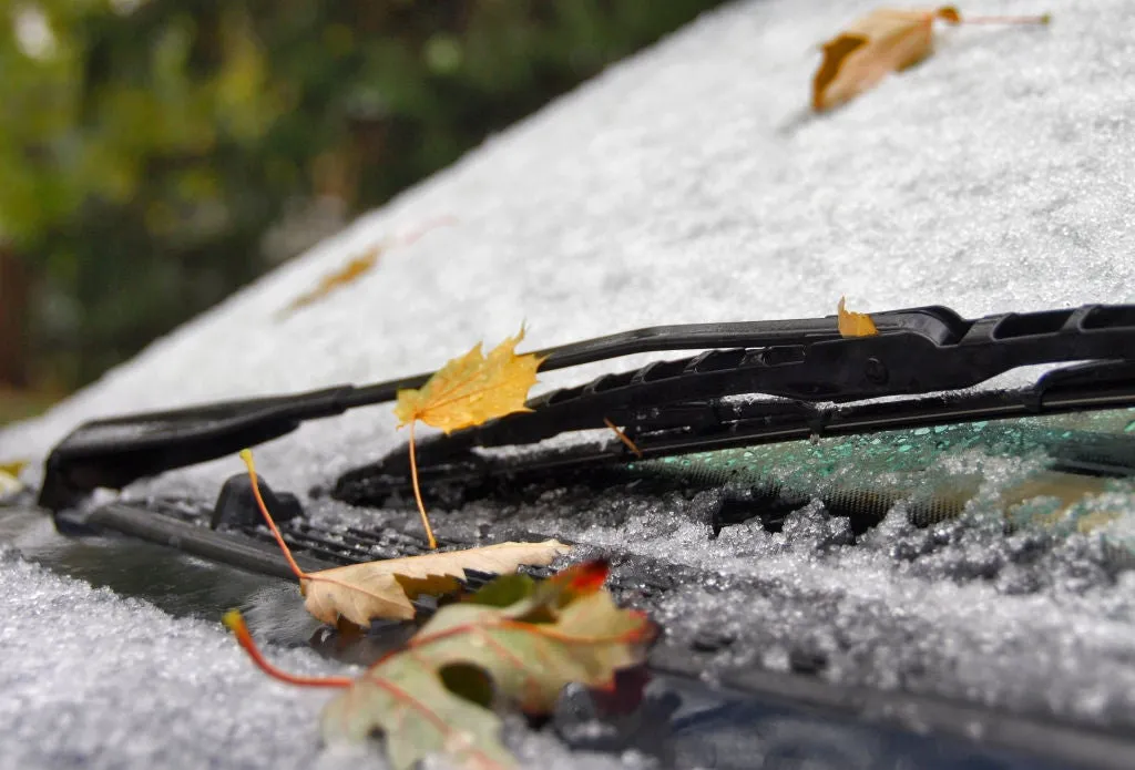
Why fall mornings bring fog, frost, and a riskier commuteFall's first cold morning can trigger a chain reaction before you even leave the driveway: Frost coats the windshield, the tire pressure lights up on your dash and fog hides the road ahead. The weather setup starts overnightFall's longer nights give the ground more time to release the heat it absorbed during the day. Clear skies let that heat escape more efficiently, while light winds keep warmer air above from mixing back down to the surface. High pressure often sets up these exact conditions — clear and calm.(MORE: Weather alerts decoded: What advisories, watches and warnings really mean) This process is known as radiational cooling, and it steadily lowers the temperature of the ground and the air just above it.
Snow, ice may hamper Friday morning commute in Manitoba - The Weather Network
Where’s the frost? Southern U.S. hits freezing before Toronto, Montreal
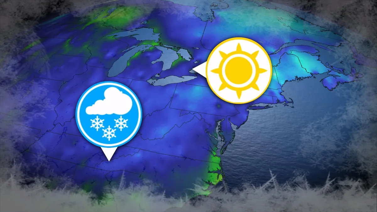
Toronto and Montreal have remained above the freezing mark every day for almost six months. While frosts and even some snowflakes have intruded across parts of Ontario and Quebec in recent weeks, the two cities have yet to reach that magic number. What’s even more remarkable is that a handful of communities across the southern United States have already dipped to the freezing point--and some have even seen accumulating snowfall. DON’T MISS: Official: Canada records first -30°C reading of the seasonThe last time we saw a freezing temperature in either Toronto or Montreal was the second-to-last week of April. Toronto hit -1.3°C early on April 20, while Montreal dipped to -2.0°C the following morning. Our average first frost in both cities occurs right around the middle of October. But warmer-than-normal years can see this milestone slide several weeks past due. Montreal once had to wait 207 consecutive days for its first frost, with the city’s first subfreezing temperature in 2017 waiting until Nov. 7. The latest Toronto’s had to wait to hit the zero-degree mark was Nov. 13, 2022.
0 comments
No comments yet. Be the first to share your thoughts!